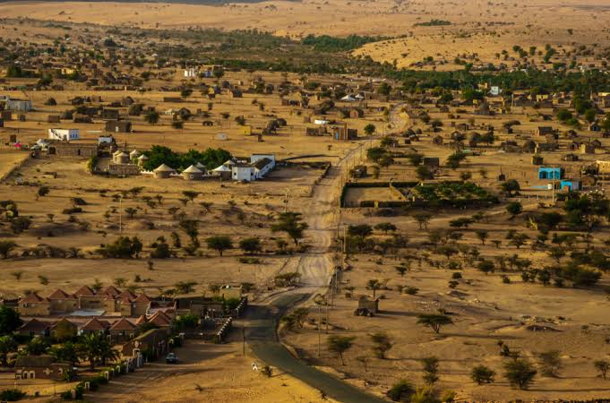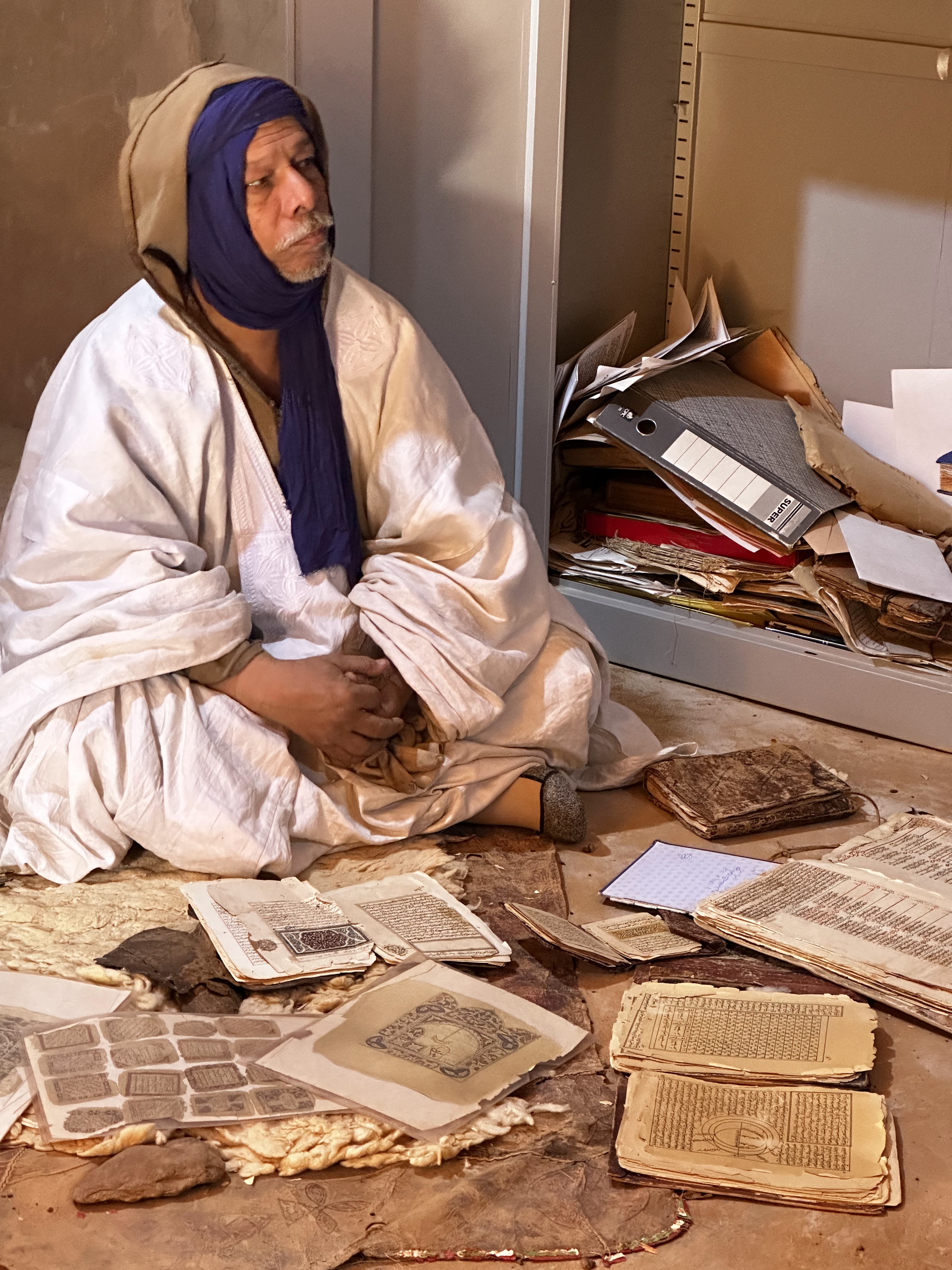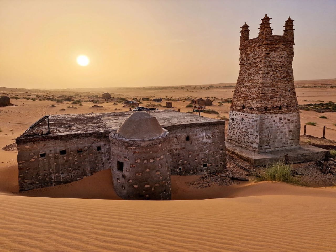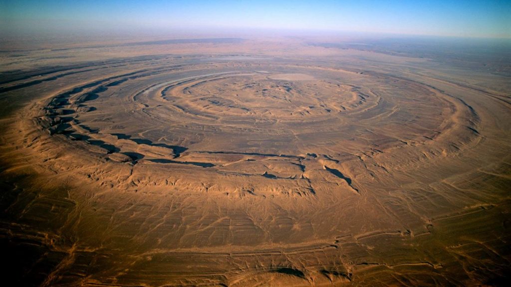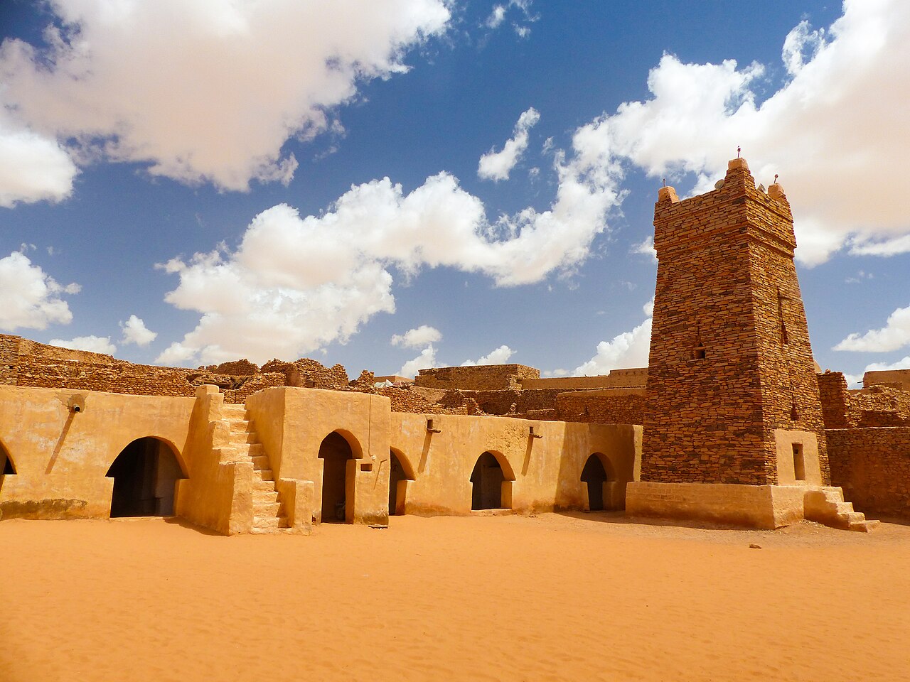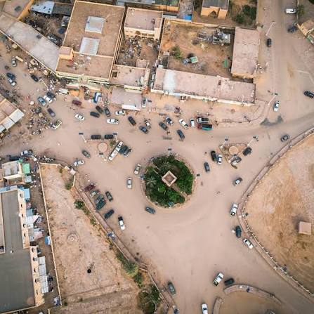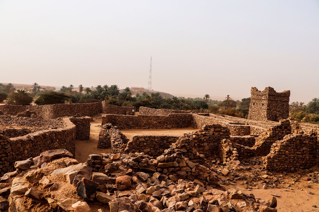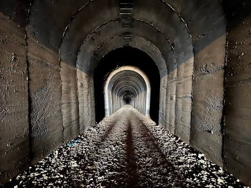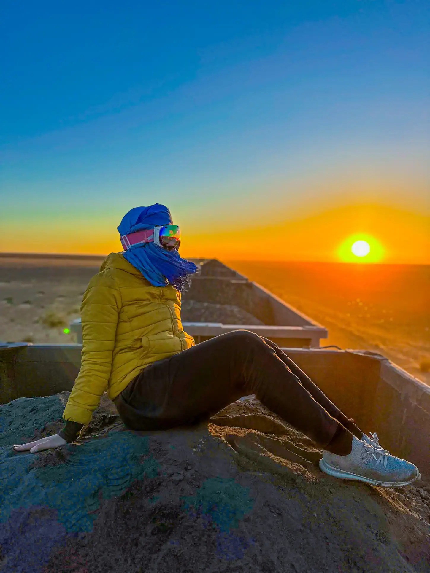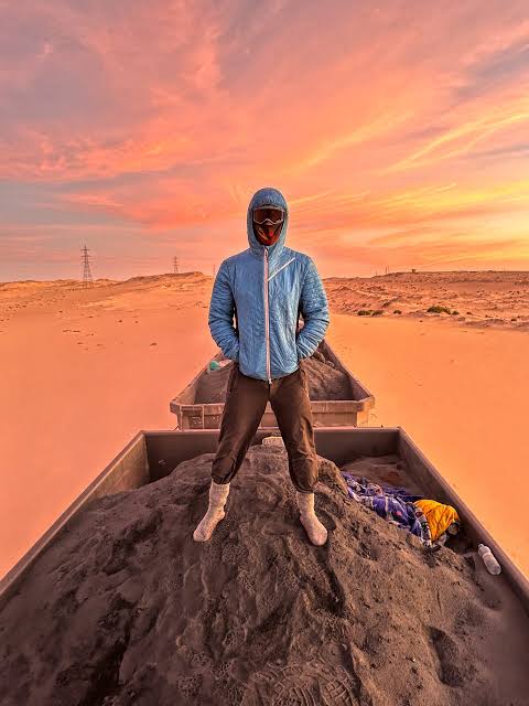
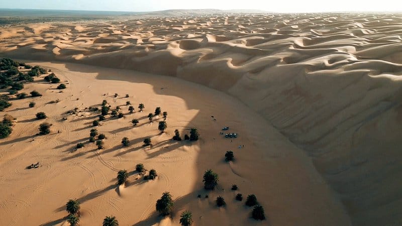
Atar is where the journey starts. Capital of the Adrar region, 435 kilometres from Nouakchott, the town sits atop the Adrar plateau on the northern border road. It is the link between the coast and the inner desert: from here the tracks run south to Terjit, east to Chinguetti and Ouadane, and out to the geological formation known as the Richat Structure. Atar is more than a stopover — it is where the modern caravans are equipped and where the distances are counted from. Anyone arriving in Mauritania for the desert passes through Atarfirst.
Atar and the Adrar
What to see
Mhaïreth Oasis
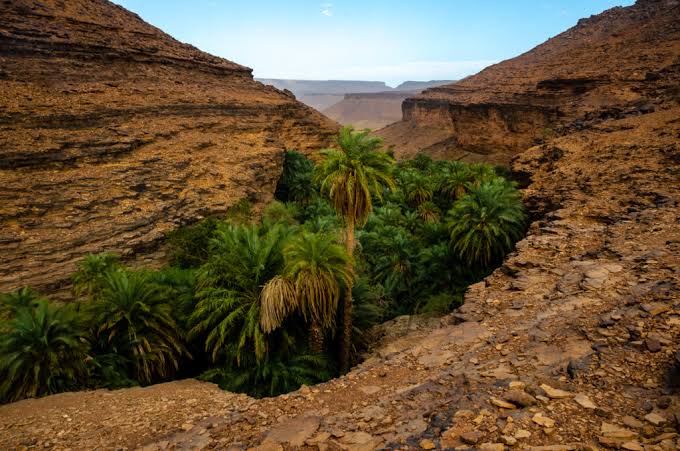
Stretching some ten kilometres along a narrow valley, the palm grove of Mhaïreth (also spelled M'Heirth) is one of the largest oases in Mauritania's Adrar. It is equally renowned for producing some of the finest dates in the region — a chance to taste these small, lightly sweet dates with local families during the traditional tea ceremony, an essential ritual of Mauritanian life. Wandering through the village is also how you meet those who live in the famous tikit, ogival huts built from palm fronds or stone.
Toungad Oasis
Set at the gateway to the White Valley, the oasis of Toungad is one of the largest palm groves in the Adrar. It falls into two distinct parts: on one side its countless rows of palm trees, on the other the village and its crops. The date harvest is the villagers' main source of income, alongside goat herding and market gardening — carrots, tomatoes and mint among them. Ringed by cliffs and ochre-coloured sand dunes, Toungad offers a breathtaking setting. Do climb to a higher vantage point during your visit to take in the sweeping view over the lush palms and the small traditional houses.
The Great Dunes of Chatou in the Oued El Abiod (White Valley)
We first head for the guelta of Toungad, where migratory birds — white storks, grey herons and various Saharan or passing raptors — are often drawn to this beautiful stretch of water. The Toungad gorge then leads us to one of the region's largest palm groves. We continue towards the Châtou el-Kbir, the big brother of the previous one, before reaching the Oued Choumat for our picnic, among springs, palm trees and colonies of hyraxes.
Hnouk
Despite a substantial human presence, we sometimes get to observe wildlife highly typical of Saharan regions. The golden jackal (Canis aureus) is well represented, as are the fennec fox (Fennecus zerda) and Rüppell's fox (Vulpes rueppelli). A few spotted hyenas (Crocuta crocuta) occasionally take animals — goats or sheep — from the herds. The honey badger (Mellivora capensis) and the crested porcupine (Hystrix cristata) are present too. Among the cats, we have been able to observe sand cats (Felis margarita), and in the autumn of 1998 one or more large, never properly identified felines moved along the whole arc of the Adrar. They may have been cheetahs (Acinonyx jubatus), or more likely caracals. Their migrations were tracked through the damage they inflicted on the camps' donkey herds; they appear to have followed the seasonal movements of the Ideï Boussat nomads coming up from the Hodh towards northern Mauritania. Making our way between rock and sand, we reach the small village of E-n-Terguent. Here too, strings of palm groves and gardens follow one another along the N'Beika wadi.
E-n-Terguent
A small village in the heart of the Adrar, reached after making your way between rock and sand. It stretches along the N'Beika wadi, where strings of palm groves and gardens follow one another through stone and dune. E-n-Terguent makes a natural stop on Adrar exploration routes and a good base for walking, camping and watching the desert wildlife drawn to the nearby water points. Its quiet, its isolation and its near self-sufficient way of life offer visitors an authentic Saharan experience, far from the busier trails.
The White Valley
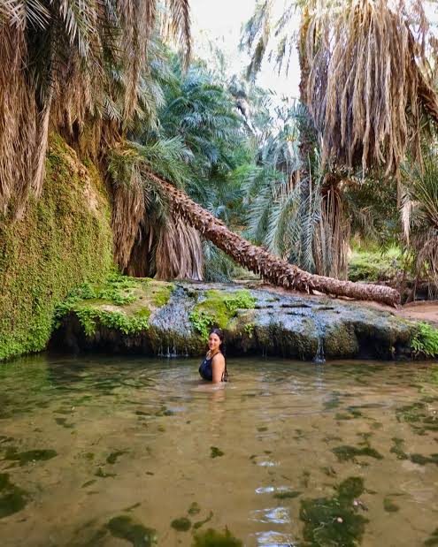
From oasis to oasis, from well to well, the plateau brings you to the dizzying Tifoujar pass, from the top of which you look out over dunes and stones coloured by water and sun in the heart of a great fault. Take in the view and let your guide point out the White Valley, one of the magical places of the Adrar region. Through a canyon of deep, narrow gorges, where the dunes seem to embrace the rock, you reach the N'Tezent canyon and its constellations: here the sky is within arm's reach. Finally, by way of the N'Tourvine pass — one of the most impressive in the region, with its air of a Saharan western — you come to the hidden gorge of Terjit, a pocket of greenery where a stream still sings, surely the loveliest oasis in all Mauritania. In the shade of date palms and rock walls, it is the perfect spot for some to sip a glass of tea while others enjoy a refreshing dip.
Tifoujar Pass
From oasis to oasis, from well to well, the plateau brings you to the dizzying Tifoujar pass, from the top of which you look out over dunes and stones coloured by water and sun in the heart of a great fault. Take in the view and let your guide point out the White Valley, one of the magical places of the Adrar region. Through a canyon of deep, narrow gorges, where the dunes seem to embrace the rock, you reach the N'Tezent canyon and its constellations: here the sky is within arm's reach. Finally, by way of the N'Tourvine pass — one of the most impressive in the region, with its air of a Saharan western — you come to the hidden gorge of Terjit, a pocket of greenery where a stream still sings, surely the loveliest oasis in all Mauritania. In the shade of date palms and rock walls, it is the perfect spot for some to sip a glass of tea while others enjoy a refreshing dip.
Fort of Bir Ziri
In Mauritania, the name "Ziri" most often refers to the Fort of Bir Ziri, a colonial-era historical site standing in the middle of the Sahara. It is an isolated outpost and a water point — bir means "well" in Arabic — deep in the desert of the Adrar region, north-east of Chinguetti and Atar. The military fort was built by the French colonial army in the 1930s and served as a support base for the Groupes Nomades, the units that patrolled the Sahara. Today in ruins but relatively well preserved, it is an essential waypoint for trekking expeditions and for 4x4 or truck circuits crossing the Maqteïr erg towards the fort of El Ghallaouiya. In purely historical terms, Ziri ibn Menad was a great Sanhaja Berber chief and the founder of the Zirid dynasty in the 10th century. Although his history unfolded mainly in the central Maghreb (Algeria and Tunisia), the Sanhaja confederation historically extended as far as Mauritanian territory — the same confederation bound up with the Almoravid epic.
Mount Aderg
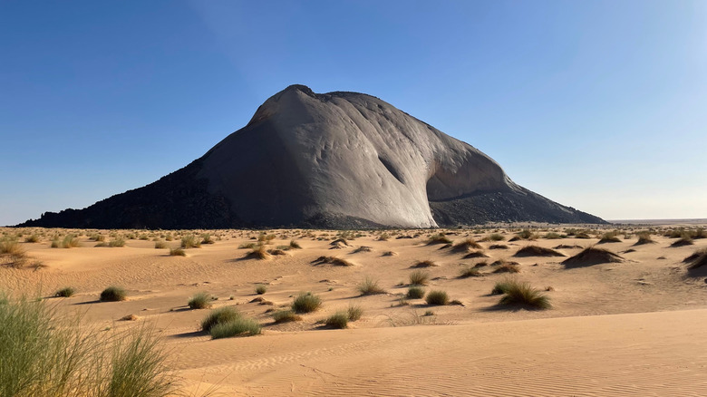
Aderg (or Mount Aderg) is a spectacular inselberg — a solitary rocky peak — rising to about 650 metres in the heart of the Mauritanian Sahara, in the famous Adrar region. Emerging from the sand like the prow of a stone ship, it serves as a major historical landmark for travellers, 4x4 expeditions and camel treks crossing the Maqteir desert (or Maghteir erg). Landscape: From the top of this promontory, an exceptional 360° panorama opens up — the waves of dunes of the Maghteïr erg on one side, and the cliff lines of the Adrar on the other. A wind-sheltered area at its foot often allows nomads to pitch their camps. Cultural and ecological importance: The upper platform of the inselberg is home to a rare plant, exceptionally rich in mineral salts, known as askâf (Nucularia perrini). It is a vital resource that nomads gather to feed and strengthen their dromedaries. Caravan history: Mount Aderg stands along an immense ancient trans-Saharan caravan route that once linked sub-Saharan Africa — the Ghana Empire in particular — to the trading posts of the Mediterranean.
Jraif
Jraif (often spelled Jreyf or Jreif) is a Mauritanian village in the department of Chinguetti, in the Adrar region. Set deep in the heart of the Sahara, it is characterised by a typically oasian and desert environment. Location: The village is reached by desert tracks from the town of Atar, the regional capital, or from the historic city of Chinguetti. Landscape: It shelters a traditional palm grove (date palm cultivation) surrounded by dune massifs and tabular sandstone plateaus. Remains of stone villages and abandoned structures bear witness to nomadic life. Local economy: Community life is organised mainly around pilot market gardening, date palm cultivation — with the date harvest during the Guetna season — and small-scale livestock rearing.
Natural
Tawaz
Tawaz is a commune and town in west-central Mauritania, in the Adrar region, forming an integral part of the department of Atar. It is a Saharan crossroads locality, known for its palm groves and its development projects. Location: Set in the heart of the tabular massif of the Adrar, close to the regional capital, Atar. Extent: The commune brings together more than twenty villages. Its territory stretches 25 km from east to west and 30 km from north to south. Population: It has around 10,500 inhabitants. The three main villages are the chief town of Tawaz, Toueizegt and Kseir Torchane. Economy and agriculture: This is one of the most populated and fertile wadis in the region: Tawaz acts as a receiving valley for the waters flowing down from the heights of the Adrar. Date palm cultivation and market gardening form the local economic engine. Culture and events: In August 2025, the commune launched the first edition of the Tawaz Festival for Culture and Development, a three-day event aimed at promoting tourism and local Saharan heritage.
Natural
Ksar el Tarchane
The tourism importance of the village of Ksar el Tarchane in Mauritania lies in its position as a major centre of cultural and historical wealth, bringing together desert tourism, heritage sports and oasis tourism. The village is located in the Adrar region, about 20 kilometres north of the town of Atar, and draws its appeal for visitors from several essential assets: 1. Traditional archery tourism and the "Guetna" festivals The Guetna archery tournament: The village is the renowned host of the "Guetna" traditional archery tournament, organised by the Mauritanian Federation of Traditional Archery. Economic and cultural momentum: These events bring together dozens of sports teams (regularly more than 40 to 52 teams), injecting millions of ouguiyas into the local economy and reviving hotels and camps, which makes the village a destination for delegations and heritage enthusiasts from inside and outside the country. The Guetna season: The village is linked to the long-established date production of the Adrar and the outskirts of Atar, which attracts tourists seeking restful experiences inside the Saharan oases and wishing to discover the traditional methods of palm cultivation. 2. Historical importance and resistance tourism The Battle of Ksar el Tarchane (1909): The village carries great historical symbolism: on 28 July 1909 it witnessed a famous battle of the Mauritanian resistance against the French occupation, led by Sheikh El Ouali ould Cheikh Ma El Ainin and Emir Sidi Ahmed ould Ahmed Aïda. Lovers of historical tourism are drawn to this area to explore the landmarks of these battles and connect them with the routes of the nearby ancient cities such as Chinguetti and Ouadane. 3. A strategic location driving desert adventures A crossing point: Thanks to the network of roads and tracks linking it to Atar and to the northern regions (such as Tiris Zemmour and Zouérate), the village represents an excellent stopover for desert trip organisers and travel agencies such as Azoueiga Tours, who run 4x4 safaris and camping under the stars.
Ten Zak Pass
The mountain pass of Ten Zak (Passe de Ten Zak), located in the Adrar region of northern Mauritania, is one of the most magical and appealing natural routes for lovers of adventure tourism and exploration in the Sahara. The pass is gaining growing tourism importance thanks to its strategic position and its rugged terrain, which appeals to travellers and explorers. The tourism importance of the Ten Zak pass can be summed up in the following points: 1. Panoramic views and captivating natural scenery The Ten Zak plateau: The elevated pass offers breathtaking, far-reaching views over the surrounding Mauritanian desert and the range of mountains below. The beauty of geographical contrast: The route blends the ruggedness of dark mountain rock with the sweep of golden sand, making it an ideal destination for photography enthusiasts. 2. Adventure tourism and off-road driving A driving challenge: The pass lies on the road linking Atar, Choum and Zouérate — a mountain road with winding dirt and rocky tracks that gives 4x4 drivers and motorcyclists a driving experience full of challenge and excitement. Camping trips: Tourists pass along this route as part of long open-air camping tours under the clear desert sky. 3. Connecting the tourist destinations of the Adrar A strategic location: The pass links the regional capital (Atar) with the northern areas such as Choum and Zouérate, making it an essential transit point for tourist groups heading to see the famous iron ore train or to explore the neighbouring historic towns and oases.
Legouinat Pass (El Aouinat)
The tourism importance of the historic Legouinat pass (or the El Aouinat area) in Mauritania lies in its being an open-air natural museum and an archaeological stronghold that links adventure tourism with the country's deep-rooted cultural heritage. The site lies along the historic desert routes and forms an exceptional attraction combining rugged terrain with historical depth. Historical and heritage value The ancient fort: The site holds the remains of an old archaeological fort that reflects the traditional architectural style of the region and buildings raised from the surrounding natural materials. The caravan road: It held a vital commercial position in the Middle Ages as one of the main staging points linking historic cities such as Chinguetti and Ouadane. Exploration and adventure tourism The mountain challenge of El Aouinat: The pass is a rugged rocky corridor that appeals to lovers of safari trips and 4x4 vehicles moving between the heights of the Adrar plateau and the great Mauritanian desert. Stargazing and camping: Thanks to the isolation of the area and the purity of its atmosphere, El Aouinat is one of the finest natural spots for night camping and observing the galaxies, far from light pollution. Oases and magnificent nature A view over the oases: The pass overlooks landscapes of Mauritanian palm oases and springs of running water among the rocks. The "Guetna" season: Local and foreign tourists are drawn to the area especially in late summer (the month of August) to enjoy the local date harvest and to relax in the shade of the palms. Festivals and oral heritage Authentic folklore: Cultural festivals are held in the surrounding areas celebrating Mauritanian poetry, traditional music and the folk tales that distinguish the society of the badia.
Historic
Tiyaret Oasis
The oasis of Tiyaret, in the Adrar region of Mauritania, is considered one of the country's most important tourist and historical destinations, owing to its unique combination of Almoravid archaeological heritage and magnificent oasis nature. The tourist and historical importance of the Tiyaret oasis Home to the archaeological city of Azougui: The oasis lies within the same surroundings as the historic city of Azougui, which was the first capital of the Almoravid state, making it a destination for lovers of history and archaeology. Agricultural wealth and dense palm groves: The oasis contains more than 1,664 palm trees, of which around 1,263 are fruit-bearing and produce the finest dates in the region. A distinctive architectural style: It is known for its beautiful traditional design, integrated into the hotel and hospitality sector, giving tourists an authentic desert-stay experience. The "Guetna" season: It attracts thousands of local and international visitors in summer, who come to restore themselves and to enjoy fresh dates, meat and traditional soup. A gateway for exploring the nature of the Adrar: It lies close to the regional capital, Atar, and offers enchanting views and mountain passes for those interested in adventure tourism and walking in the desert.
Ageunni Oasis
The oasis of Ageunni (sometimes spelled Agueni or Aqueini) is a hidden gem of the Adrar region in Mauritania, renowned for its raw beauty, its traditional oasis culture and its preserved quiet, far from the mass-tourism circuits. History and heritage The history of Ageunni is fully bound up with that of the Adrar massif, a territory that once served as a major crossroads of trans-Saharan caravan trade. A centuries-old oasis culture: For generations, the local tribes have cultivated the date palm there using ancestral irrigation methods. The time of the Guetna: Like the other Mauritanian oases, Ageunni comes especially alive during the Guetna — the date harvest season in summer — a period of family and cultural reunion and celebration. Remains and memory: The surrounding mountain environment sometimes preserves prehistoric traces (rock engravings) and bears witness to the nomadic way of life particular to the Moorish country. Tourism potential and activities Less frequented than its famous neighbour Terjit, Ageunni offers an immersion of great authenticity in the heart of the Mauritanian Sahara. Trekking and camel treks: Specialised travel agencies, such as Azoueiga Tours, often include it as a stage on walking or camel-back journeys linking Atar to the ancient cities of Chinguetti and Ouadane. A striking contrast: The site leaves a lasting impression with its green fault line of palm trees, nestled in the hollow of immense plateaus of black sandstone and dunes of golden sand. Ecotourism and encounters: It is an ideal place to bivouac under the stars, share a traditional tea with the inhabitants and understand the resilience of these communities in the face of the advancing desert.
Aoujeft
Aoujeft is a historic Mauritanian town located in the region of the Adrar. It is the capital of the region's third department, which bears the same name as the town. Aoujeft is bordered by the departments of Chinguetti and Atar to the north and east, by the region of Inchiri along its south-eastern boundary, and by the region of Tagant to the south. The department of Aoujeft is considered one of the richest departments in Mauritania in terms of natural resources. It also has substantial agricultural production, exporting vegetables in large quantities and of almost every kind to all parts of the country. It is likewise among the departments known for date production: the department exports dates of high quality, and it holds the largest palm grove in Mauritania. Aoujeft also has a great deal of livestock of every kind, with the exception of cattle — abundant beyond the boundaries of the Adrar region, but rarely found in the department. Aoujeft contains many beautiful areas and oases, such as: Ejchan oasis Rijee Abdaoua oasis (a tourist resort) Rweijee Lemam oasis Loudi oasis Amheirth oasis Tounkad oasis Dakhlet Abdaoua oasis: attributed to Sheikh Sid Ahmed ould Mohamed El Amine ould Bah Entirkent oasis Maadene El Irfane oasis Tirban oasis Terjit oasis El Meddah Timinit oasis
Loudey Oasis
The oasis of Loudey is one of the enchanting natural oases belonging to the department of Aoujeft, in the Adrar region of Mauritania. Its tourism importance lies in its being a prominent stop along the ecotourism and desert tourism routes of northern Mauritania, and it is distinguished by unique natural and cultural features that make it a remarkable destination for visitors. The charm of untouched nature and desert quiet Breathtaking scenery: It is surrounded by dense palm trees and the rock formations of the Adrar region, providing an ideal setting for lovers of nature photography. A healthy climate: It is a pure refuge for those seeking relaxation and escape from the noise of the cities, in a warm desert atmosphere. Wadis and water: It is bound up with the geography of a region rich in running wadis, which bring vitality to the surrounding desert environment. Cultural tourism and the "Guetna" experience The date seasons (Guetna): The area is known for producing high-quality dates, which makes the oasis a local and international tourist destination during the date harvest season, to enjoy traditional oasis life. Authentic hospitality: It gives visitors the opportunity to interact with the local population, to discover the customs and long-standing traditions of Adrar society, and to enjoy traditional Mauritanian tea in the shade of the palms. A strategic position among the oases of Aoujeft Tourism complementarity: Loudey lies on a tourist route linking it to other well-known oases such as Tounkad, Rijee Lemam and Terjit, which makes it an integral part of exploratory tourist journeys by 4x4 vehicle.
Tirebane Wadi
The oued Tirebane (or Tirebann) is a seasonal watercourse and a remarkable desert valley located in the heart of the Adrar region in Mauritania. The site is a key stage for travellers undertaking treks and camel journeys in the Mauritanian Sahara. Geography and landscape Location: It runs along the cliff and the plateau of Kediet Eïmer (or Kedia Eïmer), in an environment alternating between canyons of black rock and dunes of orange sand. Surroundings: The wadi links several isolated localities and lies close to the village of Jouali (or Joueyla) and to the famous oasis of Maaden. The nature of the site: It is a natural corridor lined with acacias, where the sand seeps in among the dark tabular reliefs. Tourism and hiking Bivouac: The oued Tirebane is a favoured spot for trekking agencies (such as Azoueiga Tours) to set up camps and bivouacs under the open sky. Local life: Walking up the wadi, hikers regularly come across nomad caravans and local inhabitants who use this natural pass to move between the oases.
Lebheir
Lebheir is a magnificent panoramic oasis located in the heart of the desert of the Adrar region in Mauritania. It stands out as a key, untamed waypoint along the famous road linking Atar to Tidjikja. A spectacular Saharan landscape The oasis of Lebheir nestles at the foot of rugged reliefs, just below the spectacular El Guerguar pass that overlooks it and offers a striking panorama of the greenery of the palms contrasting with the dark rock and the golden sand. Location: It lies in the rural area extending between the commune of El Medah (department of Aoujeft) and the locality of Ain Savra. Environment: The sector is surrounded by impressive geological formations, notably the depression of Dakhlet Idergâne, and by vast areas of traditional cultivation (such as the neighbouring sector of Taknez).
El Maleh Oasis
The oasis of El Maleh (known locally and on the tourist routes as "Oued El Maleh" or as the extension of the oases of El Meddah), located in the Mauritanian region of the Adrar, is regarded as an important natural and cultural attraction that reflects the enchantment of the Sahara and contributes to reviving ecotourism in the area. The oasis draws its tourism importance from several notable assets: A captivating natural contrast Greenery in the midst of drought: The oasis offers a stunning visual tableau, combining dense palm trees and generous shade that break the harshness of the surrounding sands. A gateway to the sand sea: It lies close to the famous dune belts such as the "Amatlich erg", which makes it an ideal rest stop for travellers and 4x4 vehicles in the middle of the desert. Cultural tourism and the experience of a simpler life The "Guetna" season: The oasis attracts local and foreign tourists during the summer, who come to restore themselves, eat fresh dates and drink traditional soup and milk — a traditional tourist and economic season in the Adrar. Sleeping in tikits and tents: Visitors can experience nights in a "tikit" (a hut made of palm fronds) or in the nomad camps, under the dazzling light of the stars. Its strategic position in the Adrar region A link with the archaeological cities: The oasis forms part of the safari and trekking routes that connect the regional capital, Atar, with the historic cities listed as UNESCO World Heritage, such as Chinguetti and Ouadane. Authentic Mauritanian hospitality: Local cooperatives and inhabitants serve traditional meals and authentic Mauritanian tea, providing a solidarity tourism experience that helps the oasis population to remain on their land.
Bou Aboun
Bou Aboun. The white sands stand in sharp contrast to the rocks baked by the sun. In some years, the floor of the basin may be nothing but an immense field of traditional crops such as millet, sorghum, or a variety of cucurbit known in Hassaniya as voundi. This vegetable is very important in the Moorish diet: the flesh is little used, but the large seeds are dried and ground. The flour thus obtained goes into the porridges made for children and into the soup of the month of Ramadan. At times, when the sky proves far less generous, only the acacias occupy the space. Bou Aboun is then given back to the silence of the desert.
Tinoumeind Oasis
The oasis of Tinoumeind, nestled in the heart of the Adrar massif, is a Saharan jewel combining a thousand-year-old culture with spectacular landscapes. The Adrar, a region famous for its sandstone reliefs cut through by wadis, is home to dozens of fascinating oases. The history of Tinoumeind belongs to the great tradition of oasis civilisation and trans-Saharan trade. The foggara system: Like most of the historic settlements of the Adrar region, Tinoumeind developed thanks to the mastery of water. The ingenious traditional system of foggaras (underground channels dug by hand) captures water from the water table to irrigate the palm groves in an equitable way. Earthen architecture: The oasis shelters, or faces, old ksour (fortified villages) built of rammed earth or red clay, typical of the Arab-Sudanese and Berber architectural influence of this area. Tinoumeind is a destination of choice for followers of Saharan, eco-responsible and adventure tourism. Trekking and camel treks: The oasis serves as an anchor point or a stopover for superb circuits on foot or on camel-back across the plateaus of the Adrar and the dunes of fine sand. Oasis life and the Guetna: Travellers come here in search of the coolness of the palm groves, where renowned dates are grown along with traditional market gardening. If you visit the region during the summer, you can experience the Guetna, the festive date-harvest season that brings all the oases to life. Bivouac under the stars: The ultimate tourist experience is to spend the night in a traditional nomad bivouac on the edge of the palm grove, so as to enjoy the absolute calm of the desert and a unique starry sky. Cultural immersion: The inhabitants perpetuate a deep sense of Saharan hospitality, often punctuated by the traditional mint tea ceremony and by local mystical chants.
Aïn Essafra
Aïn Essafra (or Aïn Savra) is a rural commune and a preserved oasis in the Adrar region of Mauritania, attached to the department of Chinguetti. Nicknamed "the yellow spring", it perfectly embodies the alliance between the nomadic caravan past and the revival of Saharan tourism in the Adrar. A prehistoric past: The Adrar massif holds ancient rock engravings, witnesses to a very old human presence. A caravan crossroads: The area developed thanks to the historic trans-Saharan exchanges linking the Maghreb to the Sahel. Nomadic tradition: The village of Aïn Essafra is made up of huts and a school, and shelters a pastoral population. Oasis culture: Life is organised around a wadi hidden at the foot of a cliff, favourable to the cultivation of date palms. Tourist interest A trekking stage: The oasis is an essential waypoint for trekking circuits and méharées (camel treks). Dune landscapes: The site is surrounded by barchans, magnificent crescent-shaped dunes of orange sand. Authentic resupply: Travellers stop here to fill their waterskins at the spring and to soak up Moorish hospitality. Solidarity economy: Homestays and local guides directly sustain this isolated commune.
El Berbera Oasis (Adrar) — A Canyon Palm Grove on the Oued Timinit
The oasis of El Berbera is one of the best-preserved hidden treasures of Mauritania's Adrar region. Tucked into a spectacular canyon that opens onto the Oued Timinit, this palm grove embodies both the timeless appeal of Saharan travel and the thousand-year history of oasis culture. It lies some 130 km south of Atar, the regional capital: the journey begins with about a hundred kilometres of tarmac before branching off onto a rough desert track that requires a 4x4. The name El Berbera itself echoes the history of the Berber populations — the legendary Bafour and the Sanhadja/Znaga tribes — who developed date-palm cultivation in the Sahara long before the arrival of the Arab Maqil tribes. The grove stretches for several hundred metres along a stream fed by a continuous natural spring, where the oasis dwellers keep alive a way of life built on date harvesting and market gardening, long essential to the survival of the region's nomads.
Amogjar Pass and Fort Saganne (Adrâr) — A Film Set Ruined by the Sahara
The Amogjar Pass cuts through a mineral landscape of cliffs and flat-topped mesas on the old track linking Atar to the Adrâr plateau in Mauritania. On one of those mesas overlooking the plain stand the ruins of a rare film set: Fort Saganne, built of rammed earth in 1984 for Alain Corneau's film, adapted from Louis Gardel's novel. Unable to obtain permission to shoot in Algeria, where the story is set, the production fell back on the Adrâr; the set was never dismantled and has been slowly eroding under the wind and the rare rains. The battle of Esseyen (also written In Ezzane), which partly inspired the novel, in fact took place more than 2,000 km away, in the far south-east of the Algerian Sahara. On site, the Amogjar gorge opens a passage between sandstone walls with a striking panorama over the plain, while the surrounding area conceals several shelters adorned with prehistoric rock paintings. The old track — largely abandoned since a shorter tarmac route opened further south — is driven in a 4x4 from Atar: allow one to two hours on site, with no services of any kind, ideally between October and March, and with a local guide to read the landscape and locate the ruins and nearby rock-art sites.
Agrour Amogjar (Adrar) — Mauritania's Richest Rock-Art Site
Agrour Amogjar is a rocky hill rising to 690 metres at the top of the famous Amogjar Pass, on Mauritania's Adrar plateau, and it is the country's richest and most important rock-art site. It shelters a series of rock overhangs and caves holding paintings almost 5,000 years old, evidence of a time when the Sahara was a green and fertile land. The prehistoric friezes show above all the wild African fauna of the past — lions, giraffes and cattle — alongside human figures such as hunters and herders, and scenes of pastoral and everyday life. The works are today in an advanced state of deterioration, caused both by the climate and by vandalism; to protect this exceptional heritage, a fence now encloses part of the main shelters, and access to the site is managed locally and subject to an entrance fee. Immediately beside the Amogjar Pass stand the ruins of the famous Fort Saganne, a film set built in the open desert for the 1984 film of the same name.
Natural
Oued Seguelil
The Oued Seguelil is one of Mauritania's most remarkable and most strategic natural watercourses. It lies in the Adrar region, in the north of the country, rising on the Adrar plateau, passing close to Atar, the regional capital, and then running south-west. Its date palm groves and the surrounding mountain scenery have long made it the lifeline of the region, and its economic importance grew further with the construction of a major hydraulic structure: the Oued Seguelil dam, inaugurated in 2019 and the second largest in the country after Foum Gleita. It is a gravity dam built of cyclopean concrete, 420 metres long and about 19 metres high, holding some 11 million cubic metres of surface water and up to 19 million at maximum capacity, built with government funding of around 7.5 billion old ouguiya. The dam plays a vital role in raising the water table, secures the irrigation of the historic palm groves that suffered years of drought, supports local farming, and its reservoir has hosted successful fish-farming trials providing an additional source of food. The wadi's low-lying flats have also become an attractive destination for desert travellers, drawn by the striking contrast between the sands, the green oases and the flowing water.
Natural
Oued Hamdoun (Adrar) — Seat of the Emirate and the 1909 Battle
Oued Hamdoun is a prominent historical and geographical site in Mauritania's Adrar region, in the north of the country, about 24 kilometres south of Atar, the regional capital. Two chapters tie its name to national memory. The valley was a historic centre of the old Emirate of Adrar and the seat of its leadership; and on 8 January 1909 it was the scene of the celebrated battle of Hamdoun, a hard-fought engagement against French colonial forces led by Cheikh Hassan ould Cheikh Ma El Ainin and Emir Sid Ahmed ould Ahmed Aïda, as part of the national resistance movement. Geographically, the valley has always been known locally for its link with the great Oued Seguelil: the Hamdoun area is one of the vital sites and oases belonging to that system. The setting is typically oasian — rocky mountains framing the watercourse and dense date palms along its banks, as in all the valleys of the Adrar plateau — combining the weight of history with the green of the palm grove.
Natural
Aïn Ehl Taya (Adrar) — An Oasis Town near Atar and the Seguelil Dam
Aïn Ehl Taya is a Mauritanian town and the seat of a commune in the department of Atar, in the Adrar region in the north-west of the country, lying about 40 kilometres from Atar, the regional capital. The town has a desert and oasis character, framed by the mountainous relief typical of the Adrar, in a landscape that sets bare stone against the green of the palm groves. The area is known for date-palm cultivation and irrigated farming, which form the backbone of local life, and the Seguelil dam — the second largest in Mauritania — stands within its territory: a vital hydraulic structure that raises the water table and secures farming along the valley and around it. At the 2000 census, the commune had a population of about 5,653.
Oued Ichif (Adrar) — Bivouac between Dunes and Cliffs in the Sahara
Oued Ichif is a natural site and an essential bivouac stop in the Adrar massif of Mauritania. Set in a spectacular valley ringed by dunes and rocky cliffs, this canyon is usually visited on camel treks linking the region's famous oases — Chinguetti, M'haïreth and Terjit — and is a stage on that classic route rather than a destination in itself. Access is from Atar, along sandy and rocky tracks that call for a 4x4 and an experienced driver. What draws travellers above all is camping on the valley floor between the dunes and the cliffs, under skies free of light pollution that make stargazing and Milky Way photography exceptional. At sunrise and sunset the site becomes a study in contrast between golden sand and dark rock walls, while the wadi bed itself invites walking and the exploration of side gorges on foot. After the rare rains, seasonal grasses cover the flats and nomad herds come to graze — a scene that captures the rhythm of Bedouin life in the Adrar.
Bir Amrane (Adrar) — A Well in the Hamada and a Jurassic Diamond Province
Bir Amrane is a remote desert site in northern Mauritania, within the Adrar region. Geographically and hydrographically it is classed as a water well and a desert landmark in its own right, at an altitude of about 266 metres above sea level, in an arid and intensely hot desert climate. Like all the wells of the Sahara, its importance far exceeds its size: a water point means life in a land without facilities, a bearing for travellers, and a corridor through which pastoral life and nomadic movement have passed across the desert borders for generations. Bir Amrane's scientific fame, however, comes from underground: the area forms a remarkable geological province containing at least 21 kimberlite bodies, seven of which have been shown to bear diamonds, dating from the Jurassic — which makes it a key focus for precious-mineral exploration north of the Taoudeni basin. Its landscape is the desert in full abstraction: gravel plains and hamada to the horizon, isolated hills, the faint trace of old tracks on the ground, camel herds that appear and vanish, and nights free of light pollution where the stars can be read like a map. Visiting is an experience for lovers of geology and the great deserts rather than for ordinary tourism.
The Amsaga (Adrar) — The Plateau's Edge and Land of Neolithic Arrowheads
The Amsaga (or Amesaga) is a zone of depressions and scattered massifs stretching immediately west of the great Adrar plateau in Mauritania, forming a natural transition between the Inchiri plain and the sheer cliffs of the Adrar. It is the edge where the land changes: the flat coastal plains come to an end, rocky massifs and rises begin, and the view finally opens onto the great wall of the plateau. In archaeological circles the Adrar–Amsaga complex is very well known for its Neolithic sites and the wealth of its prehistoric remains, above all the stone arrowheads scattered across the surface — witnesses to a time when this land was green and inhabited by hunters and herders. Its landscape today combines regs (stone deserts) and cordons of dunes — among them the nearby erg Amatil — alongside green oases that contrast sharply with the aridity around them. Through this zone runs one of the major mountain passes onto the plateau, the pass of Aïn Ehl Taya, which allows the climb to the Adrar and the town of Atar coming from the west or the south on the Nouakchott–Atar axis. For the traveller: a stop on the edge between two worlds, a search for Neolithic traces with a guide, and the pleasure of watching colour and relief transform within a single hour of road.
Cultural
The Market of Atar, Beating Heart of the Adrar
The market of Atar is the heart of the Adrar's capital and the living continuation of its caravan history. Born at the crossroads between the inland oases and the ocean, the town was for centuries a place of exchange where dates, salt, barley, livestock and goods from north and south changed hands. Today its lanes bring together dates from the region's palm groves, especially during the guetna harvest, spices, tea and mint, silver jewellery shaped by traditional smiths, leatherwork, wooden chests and bowls, mats, teapots and brightly coloured melhfas. It is also the stop every traveller makes before setting off for Chinguetti, Ouadane or Terjit: here you buy provisions and water and meet guides, 4x4 drivers and camel men. Wandering through it is an experience in itself — colours, scents and a direct, generous encounter with the people of the desert.
Natural
Yaghref, Oasis Commune of the Western Adrar
Yaghref is a rural commune in the western part of the Adrar region, set on the historic sandstone plateau that gives this land its sculpted rock formations and wide stone horizons. Life here follows the rhythm of the wadis: when the rains fill the valleys, the prepared fields turn green with seasonal crops, while the palm groves draw their water from wells and the underlying water table. Its oases are known for the gentleness of their air and water, sought out for rest and well-being as much as for the shade of the palms and for the guetna, the date harvest, with its evenings of tea and poetry. Its position makes it a natural stop between Atar and the great landmarks of the Adrar, foremost the Richat structure, the "Eye of the Sahara" — pure desert nature, vast silence and one of the clearest night skies anywhere.
Natural
Irat Gorge
A deep gorge dropping from the Lemmoïzine plateau towards the wadi, with its rock walls and single passage. Bedouin families live here year-round: one of the few places where the caravan meets local people in the heart of the desert. The camp is safe and sheltered from the wind.
Cultural
Mhaïreth Oasis
A green oasis whose palm grove stretches several kilometres in the heart of the Adrar, seen from above before the descent. Its houses are of banco and tikitt, and women's cooperatives work here on handicrafts. The traditional sig game is still played in the shade of the palms.
Gallery