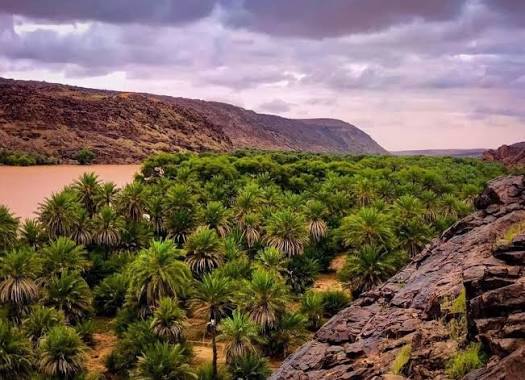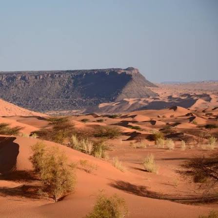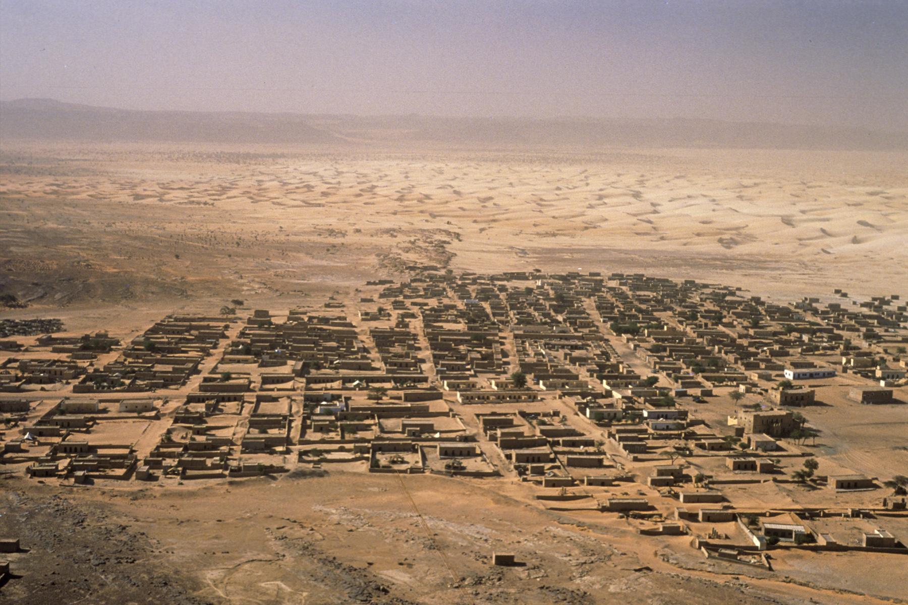
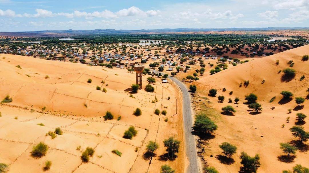
Tidjikdja is the capital of the Tagant region in central Mauritania, known locally as "the city of dates" for the dense, beautiful palm groves that line its wadi. The historic town was founded in 1660 CE (1070 AH) by members of the Idaw Ali tribe who had migrated from the historic city of Chinguetti to escape conflict there. Set on the strategic Tagant plateau, it long served as a key staging post for the caravan trade between Morocco and the Sudan. Its name is of Sanhaja (Berber) origin, variously said to mean "the well of the cows" or simply "green," a reference to its irrigated cultivation. The economy rests chiefly on date palm farming and date production. Tidjikdja is distinguished by a unique heritage architecture and by landmarks that witnessed the national resistance against French colonisation. The town is linked to several major road corridors, including the Atar–Tidjikdja road of roughly 340 km, which supports transport and tourism across the region, and it has a local airport serving the whole province.
🇲🇷 Mauritania
Tidjikdja
What to see
Rachid
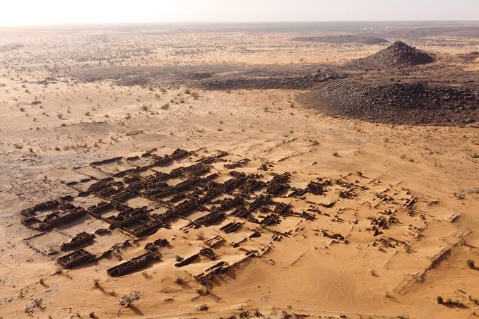
An ancient oasis town in the Tagant region of south-central Mauritania, some 40–45 km north-west of Tidjikja. Founded in the 18th century by the Kounta tribe, it stands on a rocky promontory facing a dense palm grove set in the wadi, its old ksar built in dry stone in the manner of historic Ouadane. In 1908 the town was completely destroyed by the French colonial army in reprisal for the fierce local resistance led by Mohamed Mokhtar Ould Hamid, who distinguished himself at the battle of Nimlan. The ruins of this martyred city now face the new town and remain a major site of remembrance, drawing visitors for its dunes, oases and spectacular ksar — though the remains stay vulnerable to torrential rains and climatic hazards.
 4 ⬚
4 ⬚
Taoujafet Guelta
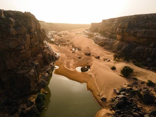
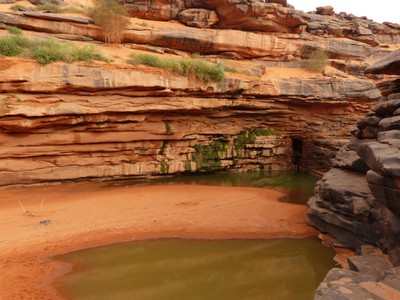
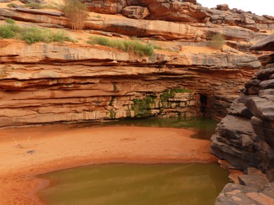
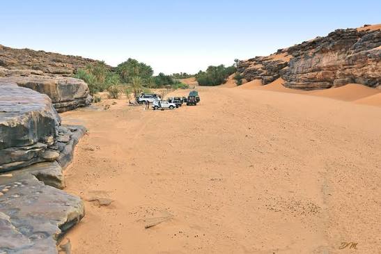
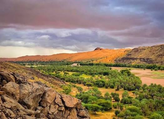
The guelta of Taoujafet is a permanent body of water and a remarkable natural stop located in the heart of the Tagant region in Mauritania. It lies in the wadi of Rachid, nestled at the foot of a hill rising to about 325 metres. Despite a rather chaotic journey from Atar, passing by the Zarga mountains and the cirque of Aouelloul, the reward is fully equal to the ordeal: the discovery of the Guelta of Taoujafet. Taoujafet marks a break, a rupture in the bed of the wadi. Over time, the waters have carved a narrow gorge, creating a permanent guelta — a paradise for farmers as well as for livestock. In a setting worthy of a mirage, the Guelta of Taoujafet is a refreshing stop, entangled in its arc of pink sandstone, where with every breath the winds drape the rock face in a delicate curtain of sand. Set within a remarkable landscape, the town of Rachid stands out for being built on a rocky promontory overlooking the wadi, whose banks are lined by a dense and bushy palm grove. Facing the new town, on the sandstone plateau, the old city rises, strangely recalling that of Ouadane. Gentleness and serenity are the words that best describe Rachid: glances are discreet, but the doors are always open to ensure a friendly welcome. From Ksar El Barka, the view over Rachid is astonishing: the new town in the foreground with its houses firmly clinging to the rocks, then the batha and the palm groves, and finally the ruins of the ancient city. The Sanhaja tribe had a reputation for mastering the entire logistics of the camel caravans with consummate skill, thanks to their perfect knowledge of the desert. In this way the Sanhaja secured the trade in gold and salt coming from southern West Africa (Bouré and Bambouk) and from the salt pans of Mauritania (F'Dérick) and Mali (Taghâza). Between 4 and 9 tonnes of gold were exported northwards across the Sahara between the 12th and the 16th century.
 6 ⬚
6 ⬚
Ksar El Barka
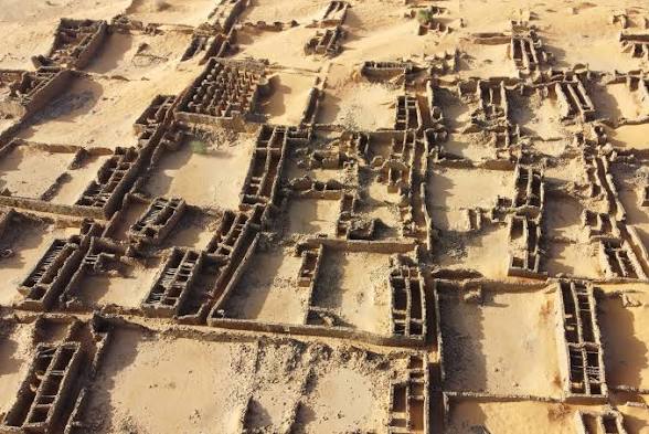
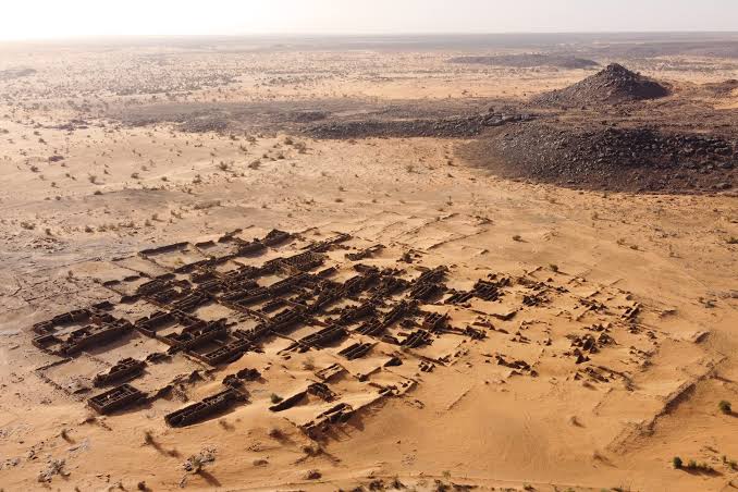
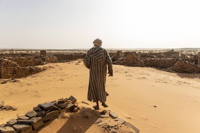
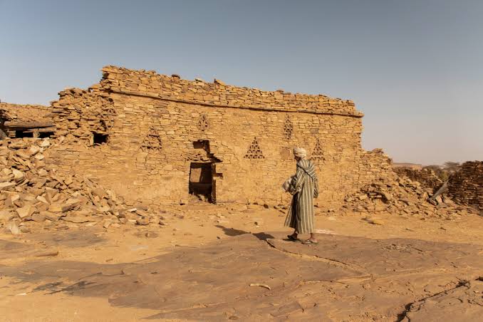
Ksar El Barka is an historic town located in the commune of Tamourt N'Naaj (formerly commune of Nbeïka), 60 km NNE of the capital, Moudjeria. It is an archaeological site where there are many vestiges of a fortified village weakened by the effects of time and the looting of men. Its architecture is particular and characteristic of the region, with its thick stone walls plastered with clay (banco) and its triangular or partitioned niches. These architectural elements, locally referred to as tachtgant, were not purely decorative. The triangular and partitioned niches built into the thick dry-stone walls served structural and practical purposes: they reduced the overall weight of the masonry while providing internal storage shelving that didn't compromise the thermal insulation of the mud-and-clay (banco) plastering, which kept the interiors cool during daytime heat waves. Ksar El Barka was created by the Kunta from Wadan in 1690. Its foundation would, in this case, be posterior, on the one hand to the invasion of Tagant by the Mâquil Arabs in the 16th century, on the other hand to the disappearance of the empires of the Niger at the end of the same century (1591: conquest of Songhaï by the sultan of Morocco). Its founder, Imam Taleb Sid'Ahmed Ben Bajed, did not belong to the first Kunta generations who came to Tagant, because the tomb of his father Bajed, that of his grandfather Sidelemin and even that of his great-grandfather Sidi Haiballah are all in Tagant. The latter is in Legbour, 24 km west of Tidjikja. But the first settlement project of the Kunta in Tagant was undoubtedly that of Ksar El Barka.
Tamourt en-Na'âj
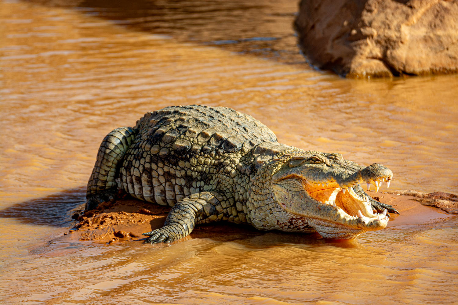
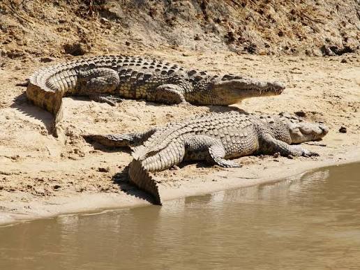
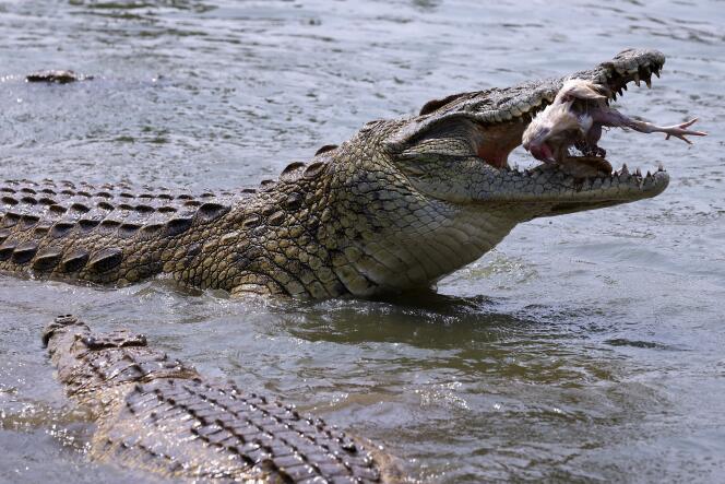
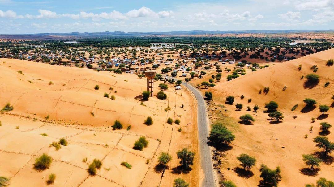
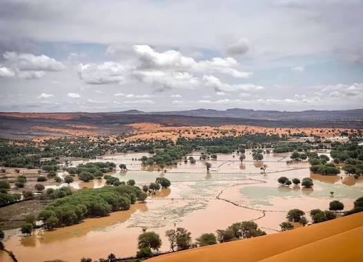
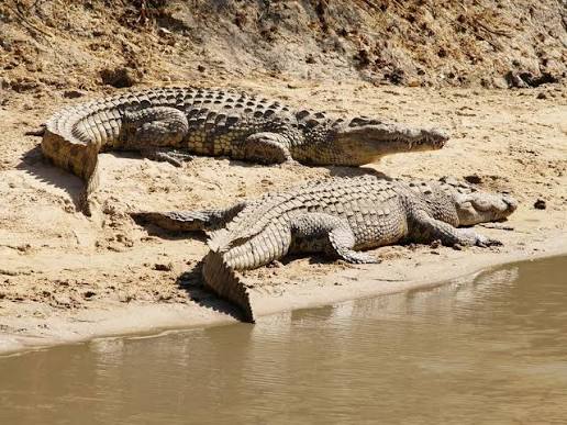
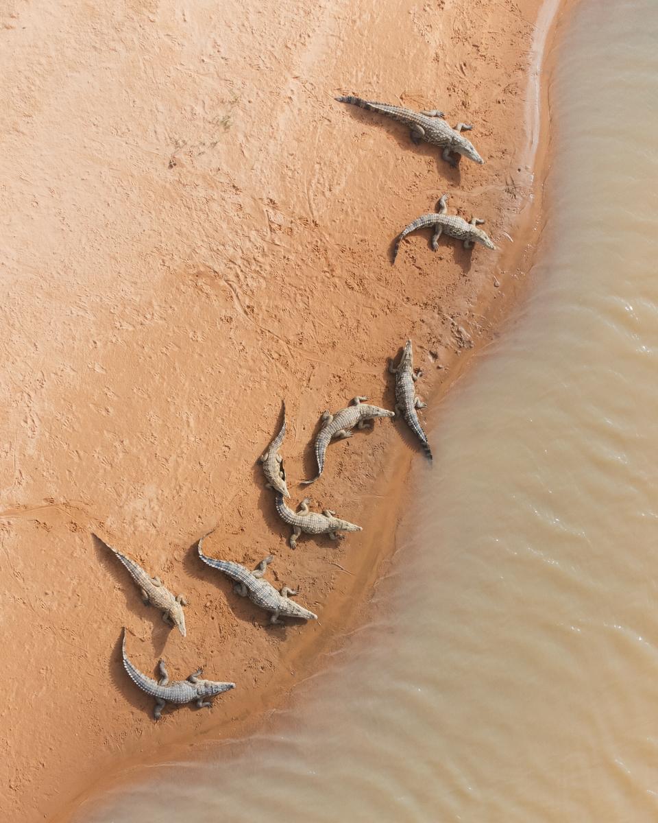
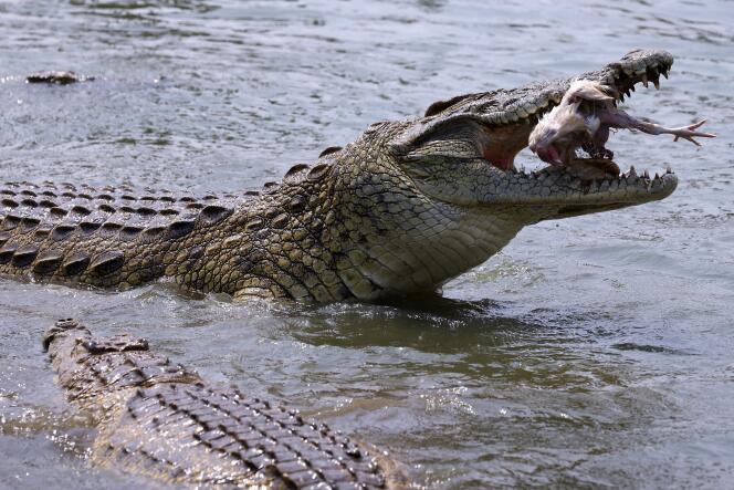
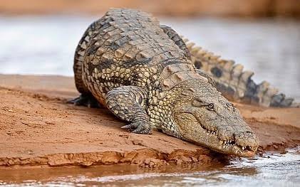
Tamourt en-Na'âj (or Tamourt Enaj) is a vast natural depression and a unique wetland located in the Tagant region, in the heart of Mauritania. This exceptional site combines a rich history of nomadic pastoralism with strong ecotourism potential, thanks to its surprising ecosystem in the middle of the desert. An ancestral nomad refuge: The depression fills with water during the rainy season, drawing the region's nomads for centuries to water their large herds. Agricultural tradition: When the water begins to withdraw, the damp banks are used for the traditional cultivation of millet and sorghum. Progressive sedentarisation: This cycle of floods encouraged many nomad families to settle, giving rise to localities such as Nbeika, the showcase of the commune. A Sahelian ecosystem: The area is home to a biodiversity rare for a desert environment, including jackals, hyenas, squirrels and a multitude of migratory birds. Desert crocodiles: The site's most famous feature lies in the presence of small desert crocodiles (West African crocodiles) which survive in the last pools during the dry season, since the Tamourt never dries out completely. Contrasting landscapes: Travellers discover here a striking contrast between the sand dunes of the Sahara, the temporary bodies of water and the surrounding palm groves.
 Natural
6 ⬚
Natural
6 ⬚
N'beika
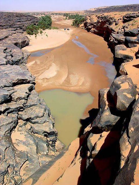
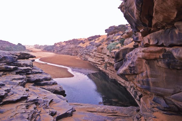
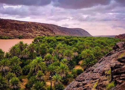
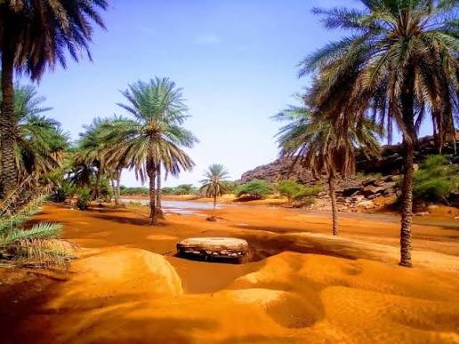
N'beika (or Nbeika) is an emblematic oasis and a major tourist crossroads located in the Tagant region, in central Mauritania. Today the chief town of the commune of Tamourt en-Na'âj, this locality concentrates nearly 25% of the regional population and marks the end of the tarmac road before one plunges into the tracks of the deep desert. The Tagant plateau, whose original Berber name evokes a "forest", has a luxuriant past that faded over the centuries under the advance of the desert. Excavations and expeditions carried out on the plateau reveal numerous rock paintings, engravings and unique funerary constructions. These traces bear witness to a very ancient human occupation, quite distinct from the nomads of the northern Sahara. The caravan era and the Almoravids: The Tagant was a pivotal zone for trans-Saharan trade and for the Almoravid movement. Not far from N'beika, the region shelters the mausoleum of Boubakar Ben Amer, the historic leader of the Almoravids. N'beika serves as a base camp or an obligatory waypoint for trekking circuits and 4x4 expeditions. The vast palm grove of N'beika: A dense and magnificent oasis offering a striking contrast with the black rock of the Saharan plateau. The Guelta of Matmatah: Located nearby, this guelta holds water permanently at the bottom of a canyon. It is one of the very few places in the world where a residual population of Saharan crocodiles (desert crocodiles) still survives.
Guelta of Matmata – The Last Crocodiles of the Sahara
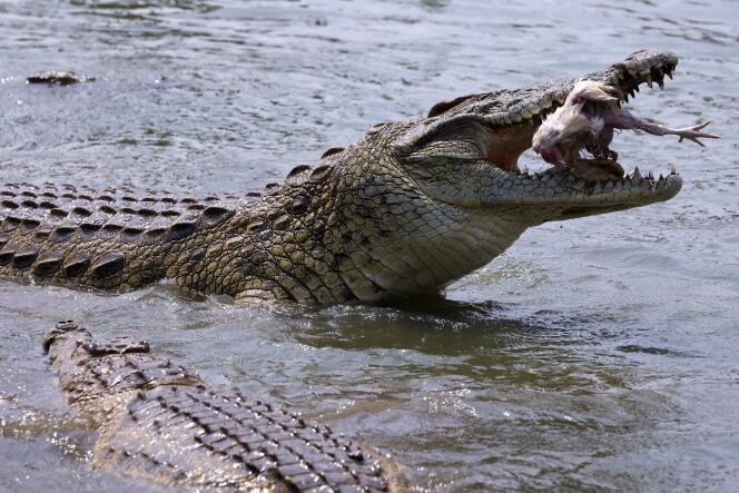
The Sahara, with its vast expanse of dunes and barren landscapes, has long captured the imagination of adventurers. Known for its extreme conditions and its cultural richness, the desert is not a place one associates with wildlife: beyond the omnipresent flies and the occasional camel, encounters are rare. Yet in the heart of Mauritania, on the Tagant Plateau, lies an anomaly — the Guelta of Matmata, home to the last Nile crocodiles of the Sahara, surviving against all odds. These crocodiles are living remnants of a time when the Sahara was unrecognisable from what it is today. Between 10,000 and 5,000 years ago, the region was lush and green, teeming with rivers, lakes and an abundance of wildlife. This verdant Sahara, part of the African Humid Period, supported giraffes, hippos, elephants and crocodiles — species we now associate with Central and Southern Africa. As the climate dried out, those animals withdrew southwards. A handful of crocodiles held on in the rock pools that keep water deep in the wadis, making Matmata one of the most astonishing sights in the desert.
Moudjeria
Moudjeria has existed since the Neolithic, as attested by the remains of dry-stone dwellings still visible on the crests of the mountain overlooking the town, and by the frequent finds of worked stone in the surrounding area — flint tools, grinding stones and arrowheads. Set beside an excellent freshwater spring rising from the mountain and surrounded by wadis suitable for farming, the village endured through antiquity and into the modern era, until French colonisation at the beginning of the 20th century turned it into a modern town. In 1905 the administrative post of Moudjeria was created by the Xavier Coppolani mission on its way to Tidjikja, marking the start of French colonial penetration into the Tagant. Moudjeria became the seat of a cercle and a thriving urban and commercial centre, drawing rural populations from the western and northern Tagant, the Agane and the Aftout to stock up in its shops or to reach the services provided by the administration. Many families, notably from Tidjikja, came to settle there. SEO title: Moudjeria – Neolithic Roots and Colonial History in the Tagant SEO description: Moudjeria, Mauritania: Neolithic dry-stone dwellings, a mountain freshwater spring, and the 1905 colonial post founded by the Coppolani mission in the Tagant.
Boutilimit
Boutilimit owes its standing as a destination to its role as Mauritania's cultural and spiritual capital, combining cultural tourism with desert exploration thanks to a long scholarly history and a strategic position in the Trarza region — an ideal stop for lovers of Islamic heritage, rare manuscripts and authentic nomadic life. The town is one of the country's foremost spiritual centres (zawaya): it houses the venerable Institute of Islamic Sciences, founded in 1956, which trained many of Mauritania's leading figures and intellectuals, alongside family libraries holding thousands of rare manuscripts — the best known being the Haroun Ould Cheikh Sidia library, which includes the first house ever built in the valley. Boutilimit is also known for its workshops of silver jewellery, leatherwork, rahla (the traditional camel saddle) and carved wooden seats, prized by visitors as souvenirs. It is the birthplace of Mauritania's first post-independence president, Moktar Ould Daddah, and its landmarks include the town's first house, the old French fort overlooking the settlement, the historic Baalatiya cemetery and a lively traditional market where colourful fabrics are sold and mhajeb pastries tasted. All around lie the dunes of the Sahara, offering campers and adventurers sandy tracks to explore and a taste of nomadic living. Boutilimit lies in south-western Mauritania, about 150 km east of Nouakchott — an excellent stopover for travellers heading inland along the Route de l'Espoir.
Magta Lahjar
Magta Lahjar owes its interest to a strategic location as a linking hub between regions, and to a cultural and environmental heritage embodied in its historic dam and its traditional schools. It is best described as an emerging local and ecological destination rather than a major tourist city, yet it holds distinctive assets. The town is a principal meeting and connecting point between six Mauritanian regions, and its position on the Route de l'Espoir makes it an essential stop for travellers and visitors crossing towards the Mauritanian east. The historic Magta Lahjar dam is one of the oldest in the country: during the rains and the autumn season it turns into a natural oasis and a destination for day-trippers drawn by the green expanses and pools of water, while the surrounding rural and desert countryside offers a taste of village tourism — nomadic life, traditional farming and stock rearing. The area is also known for its mahadras, the traditional teaching institutions that attract those wishing to explore authentic Chinguetti culture and the methods by which religious and linguistic sciences are taught. In Mauritanian popular lore, finally, the town is famed for the culture of its gatherings, its wits and its oral literature — a draw for lovers of anthropology and local culture.
 Natural
4 ⬚
Natural
4 ⬚
Sangrave
Sangrave owes its interest to a pivotal strategic position as a main transit gateway and a vital rest stop on the Route de l'Espoir, the country's most important overland artery, linking Nouakchott to central and eastern Mauritania. The commune belongs to the Brakna region in the south-west of the country, and although it is not a standalone leisure destination like the great historic towns, it holds real logistical and cultural importance for travellers heading into the depths of the Mauritanian desert. It is a strategic waypoint, offering essential services, supplies and popular eateries where local dishes can be sampled before the journey resumes. It is also a gateway to ecological and pastoral tourism: the desert expanses and grazing lands around it reflect authentic Mauritanian nomadic life and give visitors a chance to experience its simplicity and to drink green tea under the tents. Sangrave is finally a place of cultural exchange, gathering popular heritage and Mauritanian oral traditions — poetry and Bedouin music among them — that offer a living glimpse of Hassani identity.
Bou Naga
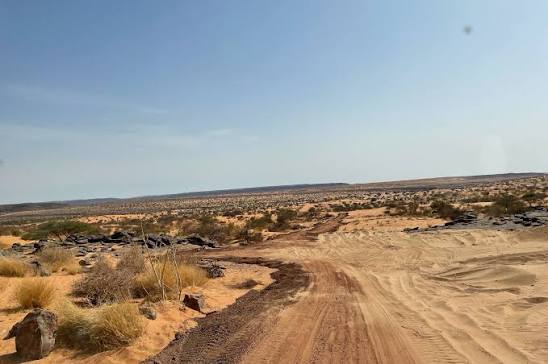
Bou Naga — literally "the father of she-camels" — designates a historic site and an emblematic former mine in Mauritania. In terms of tourism and regional history, the name belongs to the country's rich Saharan heritage and is often mentioned alongside the great caravan loops and tracks that cross the Aoukar and the Tagant. Standing in the heart of the desert, the site has long served as a traditional landmark and bears witness to the old dynamics of exchange and extraction in nomadic country. Historically it lies on the routes linking major points such as Maaden El-Ervane, N'Beika and Ksar el Barka, and along the loop around the Aoukar depression. In Moorish (Hassani) tradition, place names built on naga, the she-camel, generally mark water points crucial to the survival of trans-Saharan caravans and nomadic herders. For travellers, Bou Naga is a sought-after stage for enthusiasts of 4x4 raids, trekking and Saharan journeys off the beaten track — itineraries that usually take in the ancient cities such as Tichitt and Oualata and the grandiose dune landscapes.
 6 ⬚
6 ⬚
Néga Pass
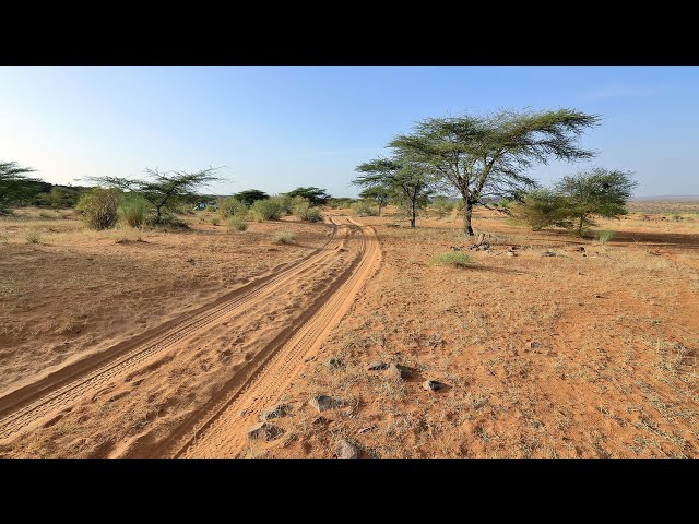
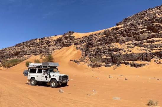
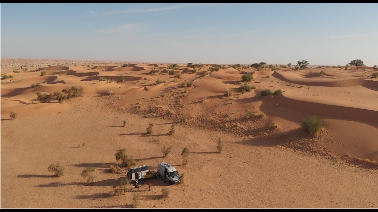
The Néga Pass, in Mauritania's Assaba region between Tidjikja and Boumdeid, is a legendary place in the history of Saharan travel and motor rallying — enthusiasts have nicknamed it "the pass you don't get through", and it embodies the ultimate obstacle-crossing challenge in open desert. Néga entered international legend during the 1990 Paris-Dakar Rally, when the configuration of the dunes and the harshness of the relief completely disoriented the era's best drivers, among them the Peugeot favourites Ari Vatanen and Björn Waldegård: the vehicles found themselves trapped in a "perfect loop", circling amid impassable walls of sand. Broadcast worldwide, the episode fixed Néga's reputation as one of the most fearsome tests of Saharan off-road driving. For lovers of adventure travel and Sahara crossings, the pass has become both an unavoidable waypoint and a technical achievement. It is usually tackled coming down from the Tagant plateau towards the plains of the Assaba — or climbing it, for added difficulty — and demands real mastery of tyre deflation and GPS navigation. Beyond the mechanical challenge, the area offers grandiose mineral landscapes, impressive sandstone cliffs and rare opportunities to bivouac under the stars far from the modern world, with isolated gueltas, surviving structures and discreet Saharan wildlife, including monkey colonies still holding out on the heights. Visits follow the fortunes of Mauritanian tourism: golden years from 2000 to 2007, when charter flights to Atar boosted Saharan travel; an abrupt halt after the security incidents of the late 2000s in the Sahel; and today a gradual revival, as expeditions, organised raids and vanlife travellers return to this mythical track.
 Natural
6 ⬚
Natural
6 ⬚
El Gadhya (Tagant) — Desert Crocodiles and Striking Landscapes near Tidjikja
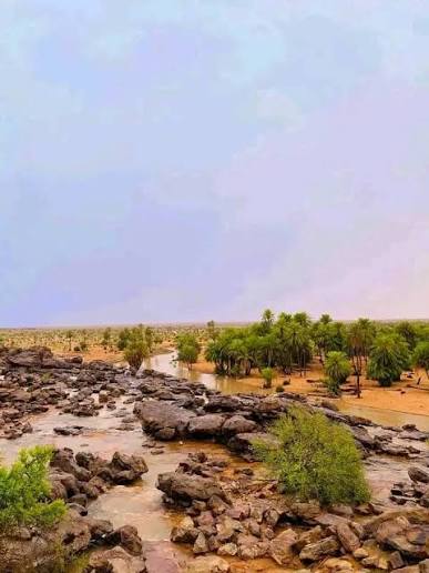
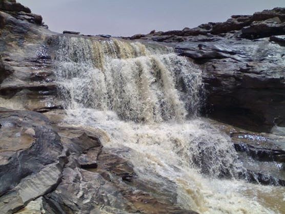
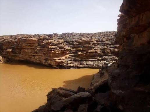
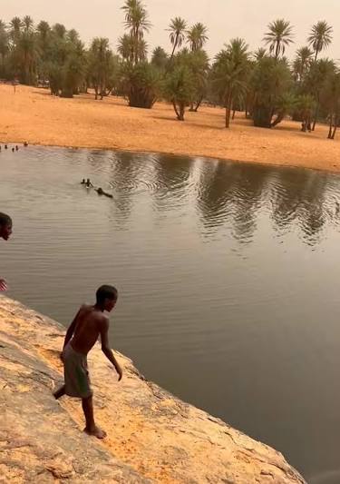
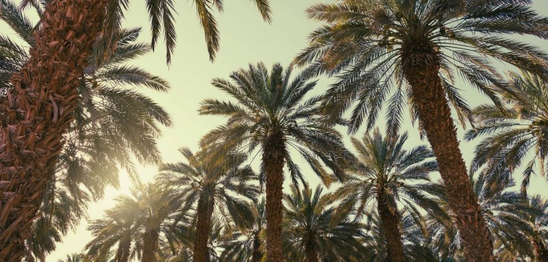
El Gadhya, officially the commune of Boubacar Ben Amer, is a rural farming town in the department of Tidjikja, in the Tagant region of central Mauritania. It is known for its striking landscapes on the margins of the Tagant plateau, where rock escarpments, wadis and cultivated land meet in a rare balance. Farming is the dominant activity — around 48% of productive activity — which gives the place a rhythm quite unlike the transit towns: here you move between fields and villages, and see the seasons of ploughing and harvest and the traditional irrigation of a valley that lives on rain. The area includes wetlands and pasture-rich ground during the rainy season, and that is its finest moment: land that suddenly turns green, pools drawing birds and herds, villages recovering their full activity. Yet the most astonishing thing at El Gadhya lives in those very waters: crocodiles. Its pools still shelter groups of West African crocodiles, survivors from a time when this land was green, and seeing them makes a visit here an experience of another order. The commune has benefited from development projects that improved its accessibility, among them the road section linking El Gadhya to Boumdeid, making it an easy stop on a Tagant circuit from Tidjikja.
 3 ⬚
3 ⬚
El Housseiniya (Tagant) — Hanging Gardens, a Blessed Spring and Desert Crocodiles
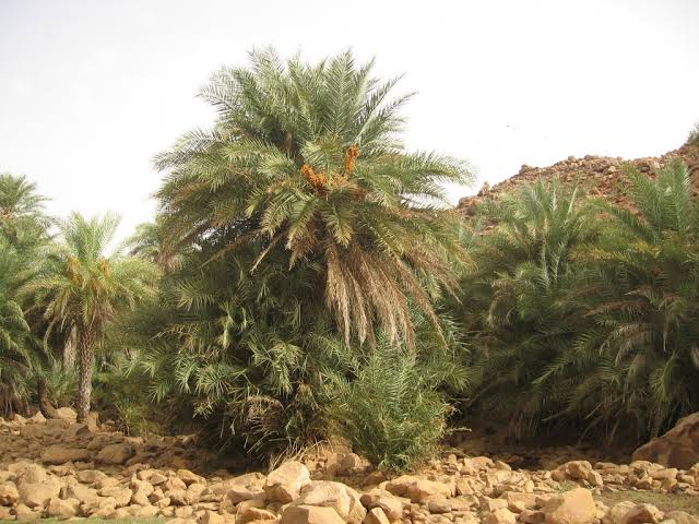
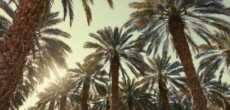
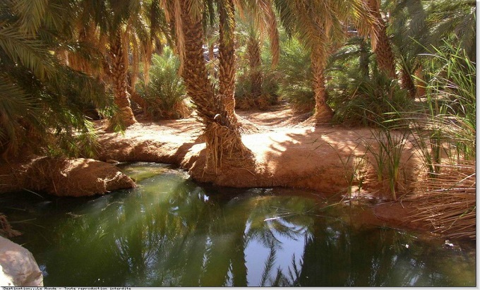
El Housseiniya is a village and a strikingly beautiful natural oasis on the western side of the Tagant region, in central Mauritania, administratively part of the commune of Tamourt en-Naaj and some 500 km north-east of Nouakchott. It sits among rugged mountain chains in a harsh desert setting, and its secret is a natural spring that never stops flowing — water that is cool in summer and warm in winter. From that spring the oasis waters its "hanging gardens": palm plots terraced along the slopes, irrigated in turn through channels, each owner guiding the water to his garden until it has taken what it needs, then passing it to the next — an irrigation system generations old and still working today. The inhabitants live mainly from date palms and date production, and grow wheat and barley when conditions allow, while drinking water and water for the herds is carried from the same spring by traditional means. Crocodiles live in the waters of the area, living witnesses to a time when this land was green and among the rarest sights a traveller can hope for in the middle of the desert. Many visitors come to seek healing in the spring water, described locally as "blessed", while the guetna — the date harvest season — is the oasis's liveliest moment, when people flock in to taste its renowned dates. Mauritanian poets have long sung of El Housseiniya, of its exceptional beauty and the endurance of its people.
 6 ⬚
6 ⬚
The Nemadi — Hunters of the Mauritanian Sahara and a Living Memory
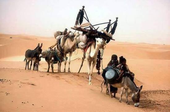
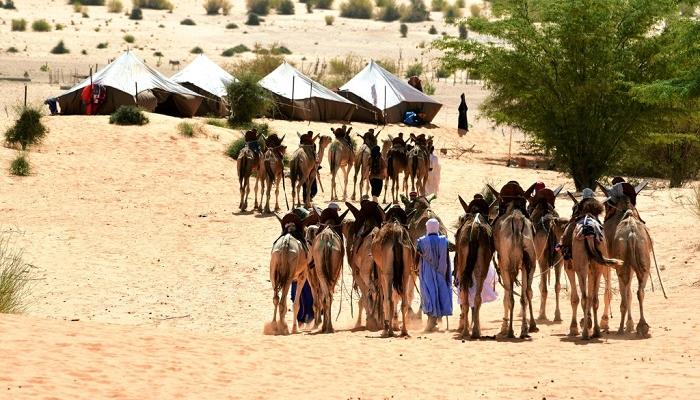
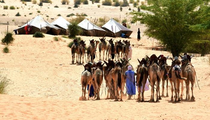
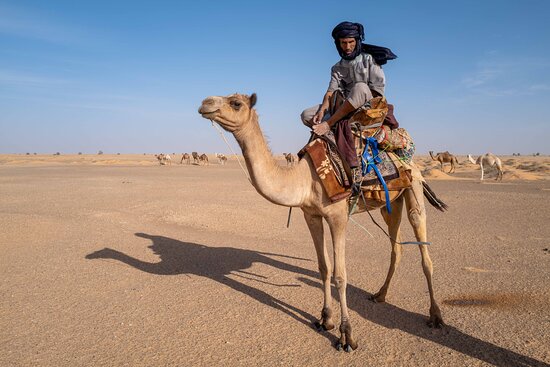
The Nemadi (also Inemadi) are a singular nomadic community of the Mauritanian Sahara, historically known for making hunting a way of life rather than a pastime. This small society lives in the north-east of the country, particularly in the deserts of the Tagant, the Hodh Ech Chargui and the Adrar, and around the historic town of Tichitt. Their name is linked in Hassaniya to the verb "atnemdi", to hunt — a nemdaï being a professional hunter — while other hypotheses trace it to old Amazigh roots carrying the same meaning. The Nemadi are not an ethnic tribe in the conventional sense: historians see them as a professional grouping formed over centuries from people of many different backgrounds and tribes, brought together by a life of isolation, by hunting, and by flight from the old wars and tribal conflicts. They are renowned for a rare mastery of tracking and reading the ground, and for hunting antelope with their trained dogs — a precise knowledge of animals, climate and plants transmitted through practice rather than books. Their importance today is above all heritage: the Nemadi are living witnesses to one of the oldest ways of life in the Sahara, one now threatened by the scarcity of game and by settlement. Visiting their regions — Tichitt and the margins of the Tagant and the Hodh — offers a chance to understand that legacy at close range, provided it is done through local mediation and with full respect for the community, far from any logic of spectacle.
 5 ⬚
5 ⬚
Maata Moulana (Trarza) — The Educational City and Its Quranic Mahadras
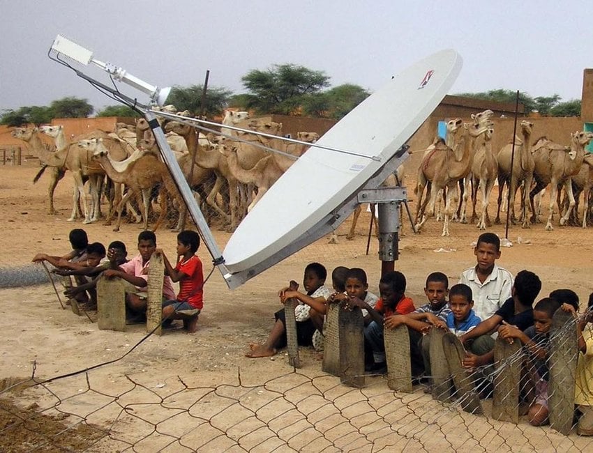
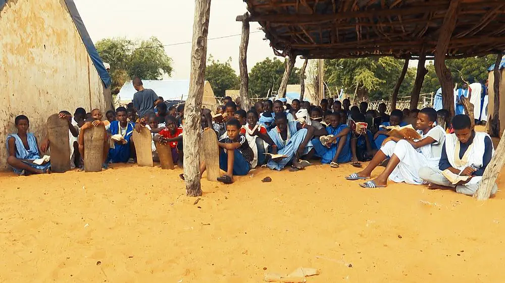
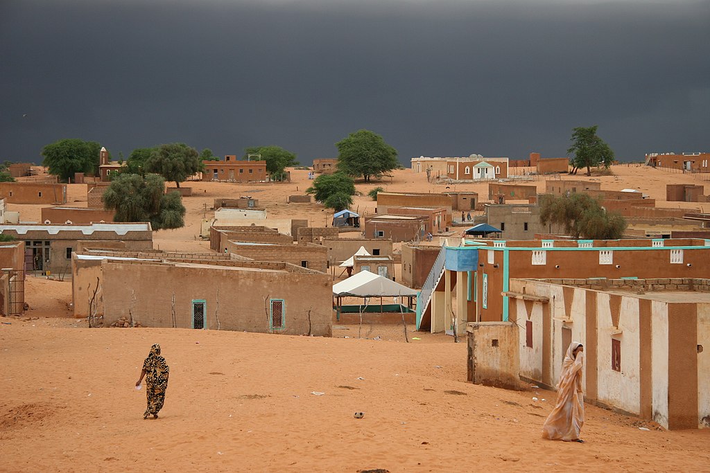
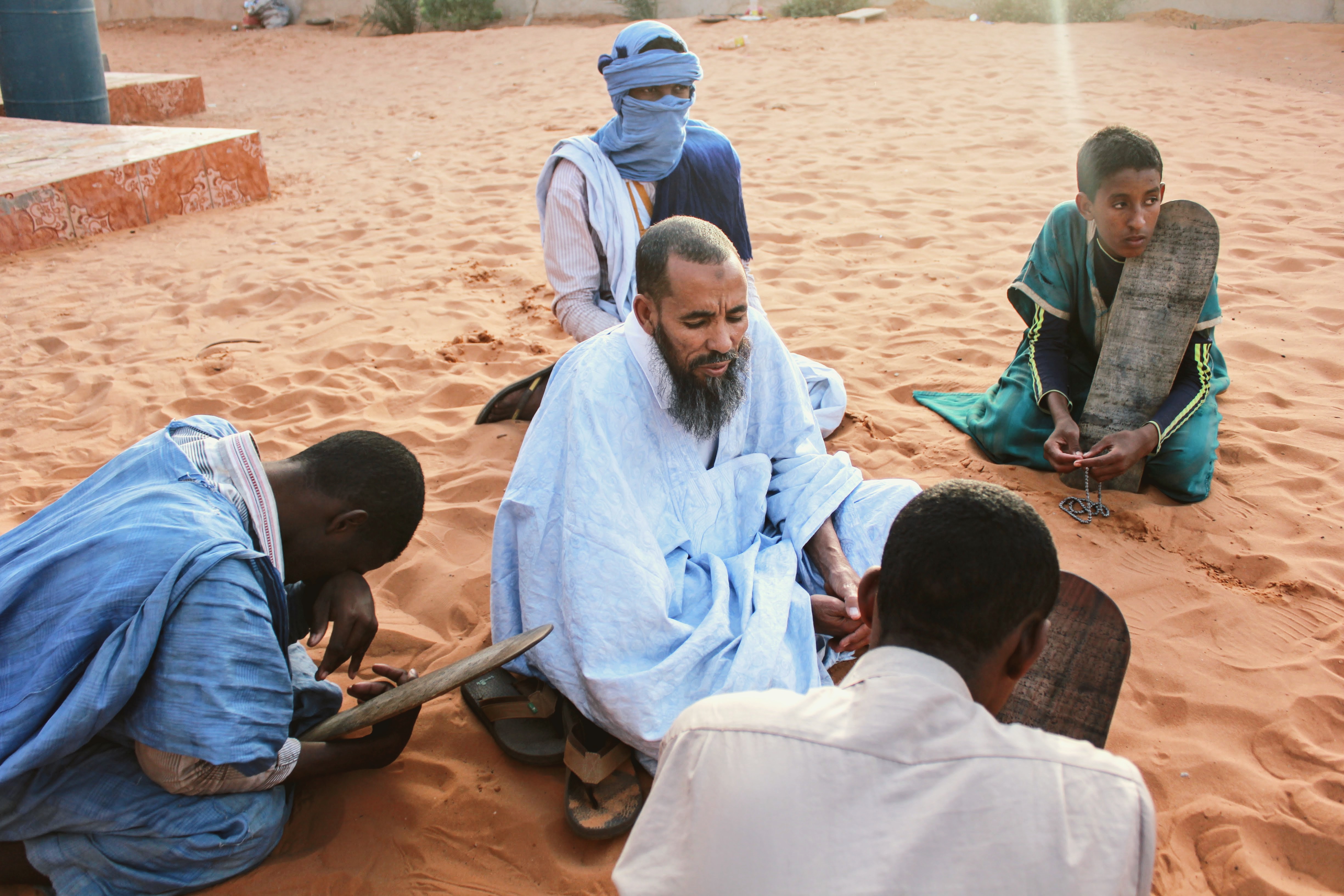
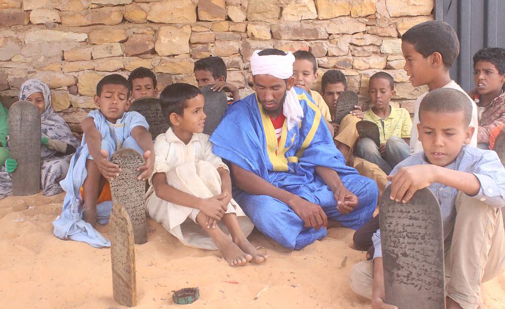
The village and mahadra of Maata Moulana is an exceptional example of an "educational city" deep in the Mauritanian desert, where material development goes hand in hand with spiritual formation and religious learning. It was founded in 1958 by Cheikh Mohamed El Mechri ould Abdallah ould El Hadj El Alaoui and lies in the El Agueur area of the Trarza region, about 180 km south-east of Nouakchott, run on a philosophy that joins faith and development. Its scholarly core is the great mahadra Ech-Cham, on the hills west of the village, teaching Arabic language, grammar and Maliki jurisprudence such as the Mukhtasar of Khalil ibn Ishaq, surrounded by a network of thirty Quranic mahadras that produce hundreds of huffaz each year. The village does not stop at traditional learning: it has a boys' and a girls' middle school and a secondary school with striking results at the baccalaureate, and it attracts students from Africa, the Arab world, Europe and America in an environment where social and ethnic distinctions dissolve. Maata Moulana belongs to the Tijaniyya order, its spiritual influence led today by Cheikh El Hadj ould El Mechri, and its social fabric brings together all Mauritanian and African communities — a Mauritania in miniature. It hosts major international events, including the international madh (praise poetry) festival and the week of "Layali Mahabbat El Mustafa" after the Mawlid, drawing thousands of visitors. Home to between 4,000 and 8,000 people under autonomous community management, it obtained running water in 1980 and electricity in 1990, introduced telemedicine in 2005, and runs farming projects and green belts against the advancing sand; four mosques serve the town, led by the Grand Mosque.
Gallery