🇲🇷 Mauritania

Chinguetti

Mauritania's Chinguetti: a city holding eight centuries of Islamic heritage

A historic Mauritanian town whose name designated the entire country across the Islamic world for centuries, Chinguetti played a leading religious, cultural and economic role along the old trade routes.

Today it preserves cultural treasures in libraries holding rare manuscripts, while facing a harsh climate and the stalling of Mauritania's development plans.

Name and history

The origin of the name "Chinguetti" remains unsettled. The most common view derives it from "the springs of the horses" in one of the region's now-extinct local languages; another traces it to the name of a nearby mountain.

A third reading links it to the Arabic word shaqit, which dictionaries generally render as pottery, or as the ceramic jars in which water is stored — though it is unlikely that classical Arabic influenced place names at so early a date.

In the local dialect the name is pronounced "Shingîti" (with a hard g), but over time the form "Chinguetti" prevailed, particularly through the written tradition and the spread of the name abroad.

Oral traditions — heavily contradictory — date the town's origins to the 8th century CE / 2nd century AH, with the founding of the settlement of "Abweir" in 777 CE / 160 AH, near the site of present-day Chinguetti.

According to these accounts, "Abweir" was the "first Chinguetti," as Ahmed Mouloud al-Hilal reports from the manuscript Tarikh Ibn Habt, by one of the town's scholars. These traditions connect the town at this stage to the rise of the Almoravid state in the desert of the veiled Lamtuna.

Whether or not the town inherited an older settlement from which the urban and human centre of gravity shifted, most sources date the founding of present-day Chinguetti to some eight centuries ago — around the mid-13th century (1262 CE / 666 AH) — when it was among the important commercial centres on the caravan routes crossing the Sahara between West and North Africa.

One of the earliest references to the town comes from the Timbuktu historian Abd al-Rahman al-Sa'di (d. 1656) in his Tarikh al-Sudan, introducing the Timbuktu judge "Muhammad Nadd," of Chinguetti origin, who wielded great influence under the Tuareg chief Akil.

Akil ruled Timbuktu around 1433, meaning the town existed in the first half of the 15th century — as Ahmed Mouloud al-Hilal reports on the authority of Abdel Wedoud Ould Cheikh.

In the early 16th century, the German author and translator resident in Portugal, Valentim Fernandes, referred to Chinguetti as the third most important inhabited town in the country at that time.

Chinguetti saw periods of prosperity from the 13th century onward, but its most striking flourishing began in the 18th century. The town secured its place as a scholarly and spiritual centre and served as a departure point for pilgrimage to the Holy Cities — a renown that spread far enough for its name to be applied to the whole country, especially in the lands of the Muslim East.

Several intertwined factors drove this: the pilgrim caravan that set out from it toward the Holy Cities; scholars travelling east to perform the hajj, debate with fellow scholars and acquire libraries — some of whom settled there, in Egypt, the Hijaz, Iraq and Sudan.

With this shift, Chinguetti no longer meant only the desert town hemmed in by the sands and mountains of Adrar; it lent its name to a vast human and territorial space, where the Sanhaja and Banu Hassan tribes fused with other components, and where social institutions took shape.

There gradually emerged the type of "the Saharan of Chinguetti, embedded in a desert civilisation shaped by Islam," in the words of the late Mauritanian historian Mohamed Ould Mouloud al-Shinnafi.

Geographical setting

The town lies in the north-western corner of the great African Sahara, in the wilaya of Adrar, about 90 km east of Atar, the region's administrative centre.

The Adrar mountains flank it to the north and west, while it opens eastward onto the vast desert, some 660 km from the border with Mali.

Chinguetti sits on the Adrar plateau in central north-western Mauritania, more than 400 km east of the Atlantic Ocean, at close to 500 metres above sea level.

Climate and water resources

Daytime temperatures are high and fall sharply at night, reaching 49 °C in heatwaves while lows drop to 10 °C. The annual average maximum is 35.7 °C and the average minimum 24.7 °C.

The climate is arid, evident in the scarcity of rain throughout the year, with rainfall not exceeding 8.5 mm annually — a major contributor to desertification and encroaching sands.

The town has fresh groundwater sources, but their level is threatened by continuous decline, as extraction increases and rainfall is too scarce to replenish the reserve.

Economy

The town's economy historically rested largely on trans-Saharan trade, which made it a commercial hub and sustained its prosperity for centuries through goods of which gold and salt were foremost.

Chinguetti was a key stop on the caravan route known as the "Lamtuni road" of trans-Saharan trade in West Africa, linking African lands to the cities of the Maghreb by way of the main desert towns.

It formed the link between the settlements strung along the caravan routes; the mines lent the desert town economic weight, placing it at the centre of commercial exchange alongside the goods passing through — dates, hides, cloth and camels.

As Atlantic trade gathered momentum over time, caravan trade through the Sahara's historic towns dwindled, amid scarce resources and outward migration, leaving these towns in economic difficulty.

The town's standing declined accordingly, as the need to carry goods on camelback gradually disappeared with the rise of maritime transport and Atlantic commerce.

The European presence on the Atlantic coasts turned into colonisation, which came to control several countries, greatly altered patterns of global trade, and transformed the means of production and transport.

Despite these challenges, the town has kept standing against storms and sands. Its people seek to improve their circumstances while maintaining activities including oasis farming, alongside the "cultural tourism" drawn by its manuscript-rich libraries and its historically valuable sites, which attract researchers and history enthusiasts. These factors modestly drive the local service economy.

Population

Chinguetti has seen unstable population figures, owing to the economic and climatic shifts it has passed through.

While the town had settled inhabitants, part of the population alternated between urban settlement and movement around it, according to the conditions of bedouin life.

Settlement was affected by severe droughts, the most recent in the 1970s, which sharply reduced the population — at some points leaving only around 400 residents.

Its population stands at roughly 6,800, according to 2013 data from Mauritania's National Statistics Office.

Landmarks and monuments

Chinguetti holds many sites of interest to visitors and tourists, especially those drawn to cultural and historical heritage.

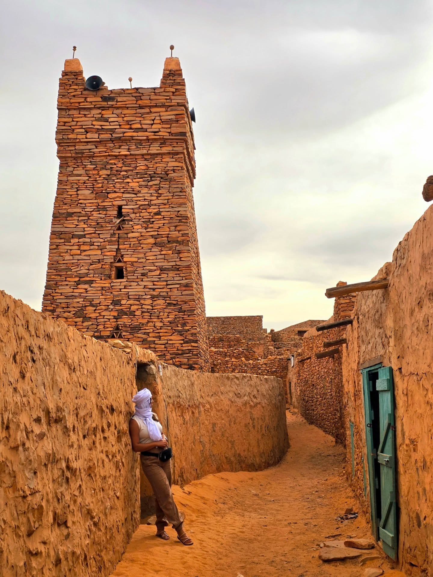
The old mosque is a 13th-century architectural landmark, embodying Saharan Islamic architecture and exemplifying the town's flourishing Islamic heritage and spiritual radiance.

The mosque's square stone minaret has acquired national symbolic value: its images and models now express Mauritanian identity in its Islamic and historical dimension.

UNESCO lists Chinguetti as a World Heritage site alongside other Mauritanian towns such as Ouadane, Tichitt and Oualata — these towns standing as unique testimony to bedouin culture and to trade in a desert environment since the Middle Ages, having been thriving centres of rich religious and cultural life that preserved their exceptional architectural pattern for seven centuries.

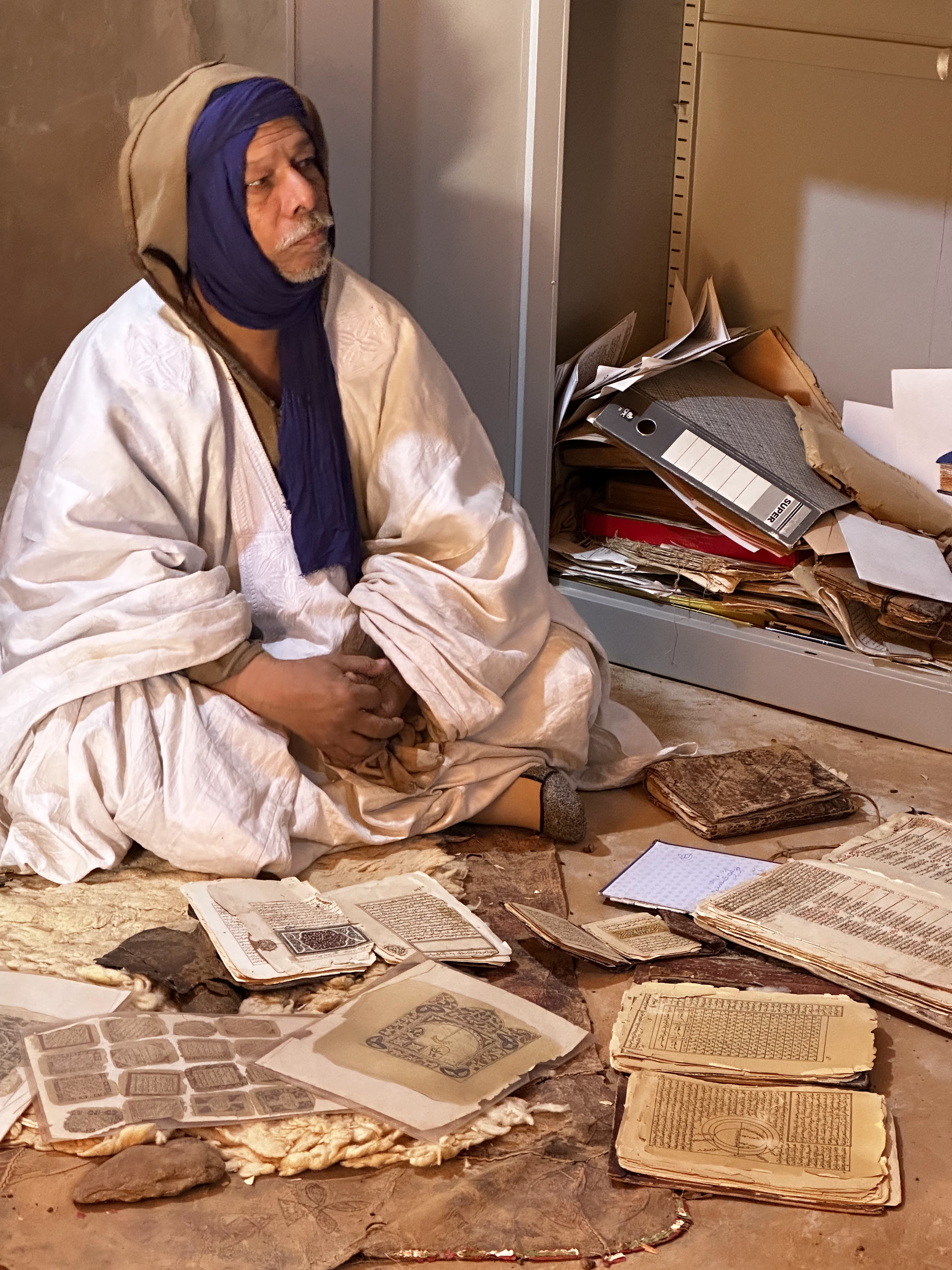
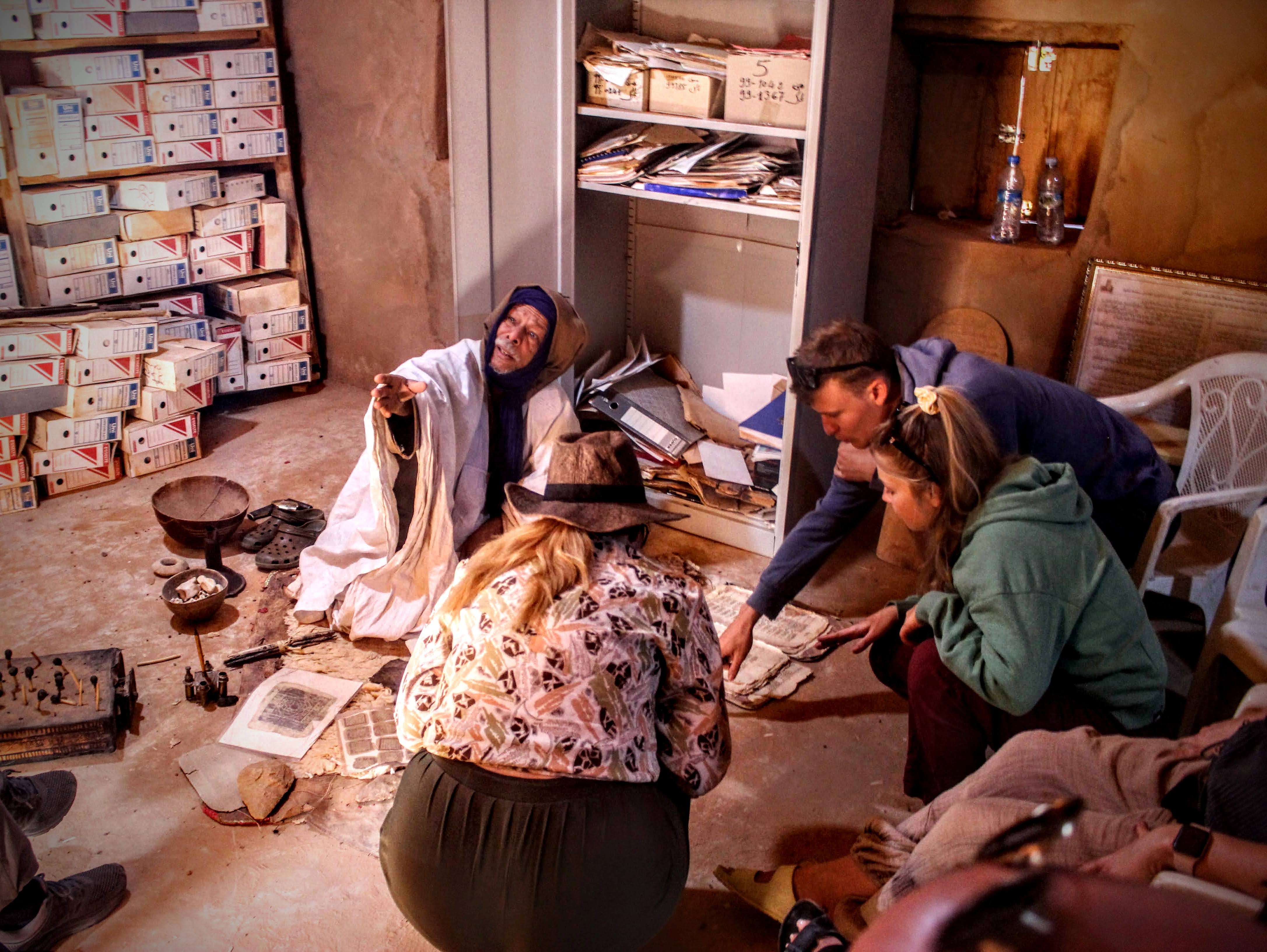
The town contains many libraries that have done much to protect manuscripts of works by some of the earliest Muslim scholars. Most are family libraries, whose preservation and the upkeep of their precious contents pass down through the generations.

These libraries draw researchers and academics interested in studying the cultural heritage of Islam in West Africa.

The catalogue of the Mauritanian Institute for Scientific Research records 3,968 manuscripts across 20 libraries in the town, most notably the Ahl Ahmed Sharif library (1,302 manuscripts), the Ahl Habt library (1,172 manuscripts), the Ahl Ahmed Mahmoud library and the Ahl Hamen library, in addition to the library of the Chinguetti mosque.
What to see

Natural

Zarga Mountains

About thirty kilometres west of Chinguetti in Mauritania's Adrar region, the Zarga Mountains form an imposing sandstone massif born of an ancient glacial moraine more than 440 million years old. The name means "multicoloured" in Hassaniya, a nod to the striking contrast between the dark rock and the waves of golden dunes climbing its flanks. Rising to almost 700 metres, this vast rock formation is one of the country's great geological curiosities — a relic of an ice age when the region lay beneath ice caps — and today marks the spectacular natural boundary where the Erg Warane comes to an end. The area also holds a very old human memory: prehistoric occupation sites and superb rock engravings and paintings, notably to the south near Guelb Al-Rawi, bear witness to a once green and populated Sahara. Eroded "ruiniform" sandstone creates labyrinthine, otherworldly landscapes, while the dunes break directly against the mountainside — an exceptional playground for camel treks and desert exploration. Zarga makes a favourite stop before or after visiting the UNESCO-listed caravan cities of Chinguetti and Ouadane.

Natural

Legueïla Oasis

The oasis of Legueïla is an unmissable, well-preserved stop on Mauritania's Saharan trails. Set in the heart of the Adrar region, it stands alone among the dune ridges of the Erg Ouarane, east of the Zarga Mountains and south-west of the famous historic city of Chinguetti. A true island of greenery lost in the sands, it offers natural shelter from the wind and the extreme desert heat. Legueïla belongs to the story of the old trans-Saharan routes — the Adrar being the historic and spiritual heart of the country — along which desert salt was once traded for millet from the savannah. Life here revolves around a small shaded palm grove given over to date growing, which traditionally sets the rhythm of the local economy during the guetna season. For travellers, Legueïla is a favourite waypoint on treks and camel caravans setting out from Chinguetti towards the far south, and an ideal shaded setting for a lunch break or a nomad camp, as used by responsible-travel operators such as Azoueiga Tours. The experience centres on cultural immersion, genuine exchange with the camel guides, and traditional nights under the stars around a campfire.

Natural

Neyana, a towering singing dune in the Erg Ouarane

Neyana is a towering singing dune in the Erg Ouarane, at the heart of Mauritania's Adrar region. This monument of sand is famous among travellers for its almost magical ability to produce a rumble or musical murmur whenever its grains begin to move. The rare acoustic phenomenon is caused by sand sliding down the slopes: a gust of wind or the passage of hikers is enough to set off a vibration that resonates like a mysterious lament or a low-frequency drone. For Moorish nomads and local camel guides, this "voice of the desert" feeds countless traditional tales, and the dune is often cast as the keeper of the Sahara's secrets. The dune valleys around it sometimes conceal precious archaeological remains from the Neolithic. Neyana has become an essential, poetic stage on Mauritania's Saharan trekking circuits, usually reached on camel caravans setting out from the holy city of Chinguetti towards the magnificent palm grove and oasis of Legueïla. Travellers climb its crest to watch sunrise or sunset over the immensity of the erg, and deliberately trigger the song of the sand by sliding down its flanks. Local agencies — such as the expeditions shared by enthusiasts on Azoueiga Tours — frequently pitch camp at its foot for an unforgettable night under the stars.

Natural

Aouelloul Crater — A 3.1-Million-Year-Old Impact Site in the Mauritanian Sahara

The Aouelloul crater is a meteorite impact crater set in the open Sahara of Mauritania. First spotted from the air in 1951 and explored notably by the celebrated scientist Théodore Monod, it is an exceptional natural laboratory for geological research. The crater measures about 390 metres across, with a present-day depth of some 10 to 30 metres, and it formed around 3.1 million years ago, in the Pliocene, gouged into a sedimentary plateau of sandstone and siliceous sand. Its scientific distinction lies in its impactites: at the moment of collision, the phenomenal heat and energy released instantly fused the desert's siliceous sands, creating glasses of molten silica in the form of greyish-green glassy droplets containing components of extraterrestrial origin such as kamacite — which definitively confirmed the crater's meteoritic origin in 1966. Scientists have also noted that Aouelloul is almost perfectly aligned with two other impact craters in Mauritania, Tenoumer and Temimichat Ghallaman. This linear alignment over nearly 600 kilometres supports the hypothesis of a simultaneous triple impact, caused by the break-up of a large asteroid entering the atmosphere on a very grazing trajectory.

Lemgalek (Chinguetti) — Great Ergs of the Adrar and Camel Treks under the Stars

The area of Lemgalek near Chinguetti refers to the spectacular dunes and ergs of the Mauritanian Adrar. These giant dunes offer the archetypal Saharan landscape: pure sand lines that shift with the light, slopes pouring down to the valley floor, and a silence broken only by the step of camels. They surround the famous caravan city listed by UNESCO, and that is what gives the area its double value — sand and memory in one place, for these same sand seas were crossed for centuries by the caravans of salt, books and pilgrims, and they still threaten the old town with their slow advance. Travellers come here for camel treks, nights under the stars and sunsets watched from the crest of a dune. Local agencies and nomad camel drivers offer multi-day treks between the region's ergs and the nearby oases, nights in camps or under a nomad tent to enjoy the clear sky, and the possibility of combining walking with visits to the old town of Chinguetti, its mosques, its libraries and its manuscripts. To explore Lemgalek is to immerse yourself in the desert while staying close to the oases and the people who live in them.

site.kind.topic

Chinguetti Libraries & Manuscripts | Sahara's Written Treasure

Chinguetti, the ancient caravan city listed by UNESCO, holds one of the most precious written memories of the Islamic world. From the thirteenth century onwards, salt and gold caravans and pilgrim convoys met here, leaving behind books and learning passed down within families for generations. Long-established family libraries — foremost the Habott library and those of the Ahmed Sharif and Hamouny families — still preserve thousands of hand-copied manuscripts on Quranic sciences, hadith, Maliki jurisprudence, grammar, rhetoric and poetry, as well as astronomy, mathematics, medicine and history. This heritage gave Mauritania its old name, "the land of Chinguetti", and made the town a beacon of scholarship in the depths of the Sahara. Sand, drought and ageing paper now threaten these treasures, making conservation and digitisation an ongoing rescue effort.

Historic

The Old Mosque of Chinguetti (Friday Mosque)

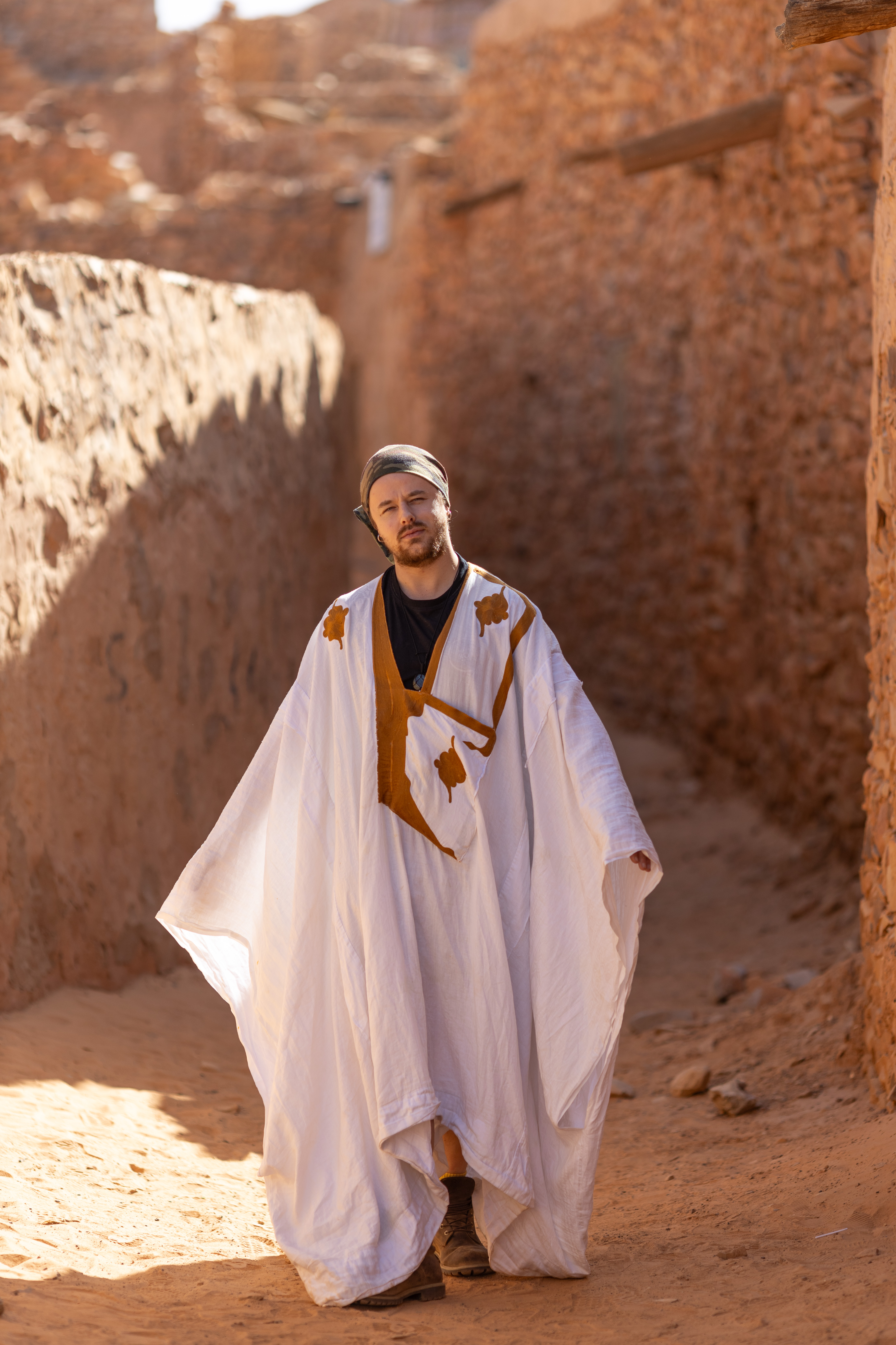
Standing at the heart of Chinguetti's old quarter since the thirteenth century, the Old Mosque is one of the longest continuously used mosques in the Muslim world. It was built of dry stone quarried in the surrounding hills, laid without mortar, so its walls share the very colour of the desert; the roof rests on palm trunks and the courtyard opens straight to the sky. Its square minaret, crowned with ostrich eggs at the corners, has become Mauritania's best-known architectural emblem, reproduced on national symbols and currency. Around it wind the sandy lanes of the ksar, listed by UNESCO, and the famous family libraries — which makes the mosque the natural starting point of any visit: unforgettable photographs at sunset when the stone glows, and a living witness to a city where caravans and scholars once met. The interior remains reserved for worshippers, but visitors are free to walk around it and photograph it from outside.

Natural

The Oases of Chinguetti: Tendoueli and Bir N'Tekmekmet

Behind the dunes of the Ouarane erg, a few hours from the ksar of Chinguetti, lie small oases like green islands in a sea of sand: Tendoueli, Bir N'Tekmekmet and other spots where a well or a spring has brought life to the emptiness. Palm trees line the edge of the wadi, and modest gardens of henna, wheat and vegetables are watered through channels shared in turn among the families, while tents are pitched near the wells where camels and goats come to drink in the late afternoon. During the guetna, the date harvest, these oases fill with residents and guests, with tea, poetry and long evenings. They make ideal stages on camel treks or 4x4 circuits from Chinguetti: absolute silence, golden dunes at sunset and a night under one of the purest starry skies in the Sahara.

Historic

Aber, the Buried Mother City of Chinguetti

Long before Chinguetti, a town called Aber stood in this corner of the Adrar; tradition dates its founding to the year 777. Its name is said to mean "the little well" in Arabic — a reminder that, like every Saharan settlement, it was born around a point of water. Aber lived as a caravan halt and a place of settlement until the sand advanced season after season and finally swallowed it; its people moved to a new site that would become Chinguetti, the city of scholars and manuscripts now inscribed on the UNESCO World Heritage list. Local memory therefore calls Aber the ancestor of Chinguetti. Today only scattered traces remain among the dunes — stone foundations, potsherds and low mounds telling the story of a town devoured by the desert. Visiting it from Chinguetti is a moving moment that sums up the long struggle between people, sand and water in this land.

Natural

Lemmoïzine Plateau

An arid, open plateau between the Zarga mountains and Wadi Irat, crossed in a full day of walking. Nothing here stops the eye: sand, stone, and a wind that erases your tracks hour after hour. Travellers come for the silence, not for the sights.

Gallery